Things to do in Banff on foot
What can you actually walk to from downtown Banff?
From Banff Avenue you can walk to Bow Falls and Surprise Corner in about 15 minutes, climb Tunnel Mountain (4.3 kilometres return, 300 metres of elevation gain) in 2 to 3 hours, reach Vermilion Lakes in 20 to 30 minutes along a flat road, and get to Cave and Basin in about 30 minutes. Johnston Canyon and Lake Louise are separate sites 20 to 45 minutes away by road and are not part of this.
A small town built at walking scale
Banff has about 8,300 residents and sits at 1,383 metres, which makes it the highest town in Canada. What matters more for a visitor without a car is where it sits: entirely inside Banff National Park, the first national park Canada ever created.
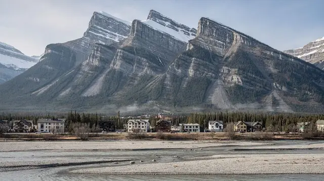
Because the townsite is inside the park boundary, commercial development here is capped by federal policy, and anyone who wants to live in Banff year-round has to demonstrate a “need to reside” tied to a job or a business in the park. That single rule is why Banff never sprawled the way a normal resort town would: the built-up area is still only a few square kilometres, wrapped by the Bow River on one side and the slopes of Tunnel Mountain, Cascade Mountain, and Sulphur Mountain on the others.
The practical result is that a surprising amount of what people come to Banff for sits within a 30-minute walk of Banff Avenue, and one genuine hike, Tunnel Mountain, starts from the edge of downtown rather than requiring a drive. This guide covers exactly those four things: the river walk to Bow Falls, the Tunnel Mountain trail, the walk out to Vermilion Lakes, and the pedestrian route to Cave and Basin. It doesn’t cover the hot springs pools themselves, the Banff Gondola up Sulphur Mountain, or the town’s museums — those each get their own dedicated coverage, linked below where relevant.
The town was founded in 1883, after railway workers building the Canadian Pacific line stumbled onto hot springs on the slopes of what’s now Sulphur Mountain. That discovery is what led Ottawa to protect the area in 1885 and eventually created the whole national park system that now covers Jasper, Yoho, and Kootenay alongside Banff. This land lies within Treaty 7 territory, home to the Îyârhe Nakoda (Stoney Nakoda), the Siksika, Kainai, and Piikani nations of the Blackfoot Confederacy, and the Tsuut’ina Nation.
Bow River to Bow Falls: the easiest walk in town
Start on Banff Avenue and head south toward the river. The pathway along the Bow River is paved for most of its length, mostly flat, and takes about 30 minutes round trip at an unhurried pace from the town centre to the falls and back. Bow Falls itself isn’t tall or thunderous by Rockies standards, it’s a wide, forceful set of rapids rather than a single drop, but the setting is what earns the stop: the Bow Valley opens out here with Mount Rundle rising on one side and the Fairmont Banff Springs hotel, the so-called “castle in the Rockies” built in 1888, visible on the bluff above.
From the falls, a short uphill spur leads to Surprise Corner, a viewpoint that frames the Fairmont Banff Springs against Mount Rundle from across the river. It’s one of the more photographed angles of the hotel precisely because it doesn’t require going near the building itself. If you want to extend the walk, a path continues from Surprise Corner up toward the hoodoos, eroded limestone pillars on the Tunnel Mountain side of the valley, adding another 20 to 30 minutes each way.
None of this requires a Parks Canada day pass to walk, since you’re moving through the townsite and its immediate pathways rather than driving into the park proper. Most visitors do already have one, since it’s checked on the highways in and out of town.
Tunnel Mountain: the one real hike that starts from downtown
Tunnel Mountain is the closest thing Banff has to a proper hike within walking distance of Banff Avenue. The trail itself is 4.3 kilometres return with about 300 metres of elevation gain, switchbacking up through forest before opening onto views over the townsite, the Bow Valley, and Mount Rundle. Most people manage it in 1.5 to 2 hours of actual trail time.
What changes the math is that the trailhead sits on St. Julien Road, on the Tunnel Mountain side of town, roughly 15 to 20 minutes on foot from Banff Avenue depending on where you’re starting. Add that walk in both directions and you’re looking at a 2- to 3-hour outing rather than a quick afternoon errand. It’s a real climb, not a stroll, so bring water and check the forecast; the upper section is exposed to wind and sun with little tree cover near the top.
The name refers to a rail tunnel that was surveyed through the mountain in the 1880s but never built, after engineers found a route around it instead; the mountain kept the name anyway. It’s a worthwhile half-day if you want elevation and a workout without leaving town, and it pairs naturally with a stop at Bow Falls on the way back down, since the trailhead access road rejoins the river pathway near town.
Vermilion Lakes: flat walking with mountain reflections
Vermilion Lakes Drive branches off just past the west end of Banff Avenue and runs along a chain of shallow lakes and marshland with Mount Rundle and Cascade Mountain reflected across the water on calm mornings. The first viewpoint is roughly 20 to 30 minutes on foot from downtown, and the road continues further if you want to keep going; it’s flat the entire way, with no elevation gain to speak of.
This is also one of the more reliable spots around Banff to see wildlife at a distance, particularly elk, and occasionally coyotes or wolves working the marsh edges. Keep at least 30 metres from elk and other ungulates and 100 metres from anything that could be a wolf, and be more cautious than usual in September and October, when the elk rut makes bulls unpredictable and occasionally aggressive even close to roads and parking areas. Vermilion Lakes is one of the better sunrise photography spots near Banff for exactly this reason: still water, open sky, and mountains without having to drive anywhere.
Cave and Basin: the walk to where the park system began
Cave and Basin National Historic Site is about a 30-minute walk from downtown Banff along Cave Avenue, mostly flat with a short rise near the site itself. This is not the soaking pool — that’s Banff Upper Hot Springs, a separate site further up the mountain — but rather the actual cave where those CPR workers found the hot springs in 1883, which led directly to the creation of Banff National Park two years later.
The site includes boardwalks through the cave and around the outdoor basin, exhibits on the discovery and the park’s founding, and a marsh trail behind the building that’s worth the extra 20 minutes if you have time. The cave and basin also happen to be the only known habitat of the Banff Springs snail, a species found nowhere else on Earth, which is one of the reasons swimming here has been closed for decades even though the original discovery involved bathing in the warm water. Budget an hour on site plus the walk each way.
What’s nearby, but not walkable from the townsite
It’s worth being blunt about this, because online lists sometimes blur the distinction. Johnston Canyon is about 25 kilometres from Banff and takes 20 to 25 minutes by car or Roam Transit; it is not accessible on foot from downtown. Lake Louise is 58 kilometres away, roughly 45 minutes by road. Both are genuinely worth visiting, but they’re separate destinations requiring a car, a bus, or a tour, not extensions of a Banff townsite walk. If you’re planning to see both in the same trip, our guide to getting around without a car covers how Roam Transit and shuttles connect them.
Distances and times at a glance
| Walk | Round-trip distance from Banff Avenue | Elevation gain | Time budget |
|---|---|---|---|
| Bow Falls and Surprise Corner | About 3 km | Minimal | 30–45 minutes |
| Tunnel Mountain (trail plus walk to trailhead) | About 5–5.5 km | 300 m | 2–3 hours |
| Vermilion Lakes (first viewpoint) | About 2.5 km | None | 45–60 minutes |
| Cave and Basin | About 4 km | Minimal | 60–90 minutes with the site visit |
These are ordinary walking-pace estimates; adjust up if you’re travelling with young kids or stopping often for photos.
When to go and what to bring
Bow Falls, Vermilion Lakes, and Cave and Basin are walkable in every season, though winter means packed snow and ice on some stretches of pathway, so footwear with real grip matters more than the distance suggests. Tunnel Mountain is best tackled from late spring through fall; it can hold snow and ice into May at the higher switchbacks. Summer afternoons bring the heaviest foot and vehicle traffic on Banff Avenue itself, so an early start avoids both crowds and the day’s heat on the exposed upper stretch of Tunnel Mountain.
None of these routes cross bear country in the way a backcountry trail does, but Banff National Park is still grizzly and black bear habitat, and bear spray is worth carrying on Tunnel Mountain specifically, since it climbs into forest away from the townsite’s constant foot traffic. Vermilion Lakes and the Bow River pathway see enough people that surprise encounters are less likely, but never feed or approach any animal you see. If you want the general rules on carrying and using spray, including what happens at airport security, see our guide to bear safety and bear spray.
Layers matter more than most first-time visitors expect. Even in July, the Bow Valley can swing 15 degrees Celsius between a sunny midday and a shaded morning start, and the exposed switchbacks on Tunnel Mountain catch wind that the townsite below doesn’t feel at all. Solid footwear with grip helps everywhere here, not just on Tunnel Mountain; the Cave and Basin boardwalks and the Bow River pathway both ice over in patches through winter even when the streets in town have been cleared.
A flat alternative if you want to keep going
If Vermilion Lakes leaves you wanting a longer, still-flat walk, the paved Legacy Trail continues from the western edge of Banff toward Canmore, following the highway corridor rather than the river. It’s built for cyclists as much as walkers and most people cover only a portion of it on foot before turning back, but it’s worth knowing about as an option on a day when Tunnel Mountain feels like too much climbing.
It also underscores something worth remembering about this whole guide: distances that look small on a map, like the 26 kilometres to Canmore, are still a full day’s undertaking on foot, and the practical way to cover them is Roam Transit or a shuttle, not walking the whole route.
If you’d rather have someone else lead the way
Not every visitor wants to figure out the routes and the history alone, and Banff’s small footprint makes it an easy town to cover with a guide in a few hours. A walking tour through Banff’s townsite, covering its founding, key buildings, and viewpoints along the way works well as an orientation on your first day, before you strike out on your own toward Tunnel Mountain or Vermilion Lakes.
If food is part of what you’re after, a guided food walk through Banff with tastings along the route combines the same townsite ground with stops most visitors would otherwise miss. There’s also a shorter town walking tour with a snack included, useful if you only have an hour or two before heading out to the trails on your own.
Frequently asked questions about walking around Banff
Can you walk to Johnston Canyon or Lake Louise from downtown Banff?
No. Johnston Canyon is about 25 kilometres and 20 to 25 minutes by road, and Lake Louise is 58 kilometres and roughly 45 minutes. Both need a car, Roam Transit, or a tour; neither is within walking distance of the townsite.
How long does the Tunnel Mountain hike take from downtown?
Budget 2 to 3 hours round trip if you start walking from Banff Avenue rather than driving to the trailhead. The trail itself is 4.3 kilometres return with about 300 metres of elevation gain, and the walk from downtown to the trailhead on St. Julien Road adds roughly 15 to 20 minutes each way.
Is the walk to Vermilion Lakes safe without a guide?
Yes for most of the year, but stay alert. Vermilion Lakes Drive runs along open marshland where elk, and occasionally wolves or coyotes, are commonly seen. Keep well back from any animal, and be especially cautious in September and October during the elk rut, when bulls can be aggressive even close to roads.
Do you need a Parks Canada pass to walk around Banff townsite?
No day pass is checked for walking on Banff Avenue, the Bow River pathway, or the Cave and Basin boardwalks, since the townsite itself functions as a regular Canadian town. You do need a Parks Canada pass to be in Banff National Park generally, and it’s checked on the highways into and out of town, so most visitors already have one.
Is the walk from downtown to Cave and Basin worth it if I’m not soaking anywhere?
Yes. Cave and Basin is a national historic site, not a soaking pool, so the appeal is the cave itself, the boardwalks, and the story of how Canada’s national park system began here, not hot water. If you want to actually soak, that’s Banff Upper Hot Springs, a different site with its own access.
What’s the easiest walk in Banff for someone who doesn’t want to climb anything?
The Bow River pathway from downtown to Bow Falls and Surprise Corner is flat, paved for most of its length, and takes about 30 minutes round trip at an easy pace. Vermilion Lakes Drive is also flat, though longer.
Can you do all four walks in this guide in one day?
Physically yes, but it’s a full day rather than a relaxed one. Tunnel Mountain alone takes half a morning or afternoon with the walk from downtown included. Most visitors split these across two days, or pair Bow Falls and Vermilion Lakes on one easier day and save Tunnel Mountain for when they have more time and energy.
Banff sightseeing on GetYourGuide
Verified deep-linked GetYourGuide tours. Book through these links and we earn a small commission at no cost to you.
GetYourGuide does not provide a product photo for this activity — the image shows the meeting point, photographed by us.