Ask anyone standing on Banff Avenue to point at “the mountain” and they’ll usually point two different directions and mean two different things. The peak framed at the end of the avenue is Cascade Mountain. The long, tilted wall of rock rising behind the Banff Springs Hotel and the golf course, the one that shows up in half the postcard shots of Vermilion Lakes, is Mount Rundle. It’s one of the most photographed mountains in the Canadian Rockies, and one of the most misunderstood.
The confusion isn’t really about the mountain itself; it’s about what “visiting” it means. For the overwhelming majority of people who come to Banff, visiting Mount Rundle means standing somewhere in the valley and looking at it, and that’s a completely legitimate way to spend an afternoon. For a much smaller number of experienced scramblers, visiting Mount Rundle means an 8-to-10-hour day on loose rock with real exposure near the top. This page is written to keep those two groups from accidentally swapping places.
Two different mountains, two different experiences
The confusion is almost always the same one: mixing up Mount Rundle with Tunnel Mountain. Both sit close to town, both have a distinctive silhouette, and both get pointed at from the same viewpoints. But Tunnel Mountain has a signed, maintained trail that gains 300 metres over 4.3 kilometres round trip, doable by most fit visitors in a couple of hours.
Mount Rundle has no such trail to its summit. The route up is an unmarked scramble over loose rock with real exposure, gaining more than 1,000 metres, and it takes most parties 8 to 10 hours round trip. Treating the two as interchangeable, or assuming Rundle is “Tunnel Mountain but a bit longer,” is how people end up in trouble on a mountain that doesn’t forgive that mistake.
This page covers both sides of Mount Rundle: how to see it, and what it actually takes to climb it. If what you want is a manageable half-day hike with a view over Banff, the Tunnel Mountain hike guide or Sulphur Mountain on foot are the pages you want, not this one.
Where Mount Rundle actually is
Mount Rundle forms the long ridge on the south side of the Bow Valley, stretching from just outside Banff toward Canmore. It’s visible from Banff Avenue if you look south rather than up the avenue itself, from Bow Falls, from the Banff Springs golf course, and, most famously, reflected in Vermilion Lakes on a calm morning. Driving the Trans-Canada Highway toward Canmore, the mountain stays in view for most of the 26-kilometre stretch, changing shape as the angle shifts.
The mountain is named after the Reverend Robert Rundle, a Methodist missionary who worked in the area in the 1840s, decades before the town of Banff existed. Like most colonial-era names in this valley, it sits on land that is the traditional territory of the Stoney Nakoda (Îyârhe Nakoda), the Blackfoot Confederacy (Siksika, Kainai and Piikani), and the Tsuut’ina Nation.
The shape that gives it away
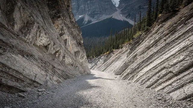
Mount Rundle’s outline is distinctive for a geological reason, not a coincidence of erosion. The mountain is built from tilted layers of sedimentary rock, and the tilt means one side slopes gently while the other drops away in steep cliff bands. That asymmetric profile, a long gentle ramp on one side and an abrupt wall on the other, is what makes Rundle instantly recognizable against the more jagged, symmetrical peaks nearby. Geologists use “Rundle” as the name for this entire local rock formation, a limestone unit that shows up across much of the front ranges of the Rockies. The same tilted-strata pattern is part of why the standard route up is loose and awkward: hikers are essentially climbing up broken rock bands, not a solid ridge.
Rundle isn’t a single sharp summit either. The ridge carries several bumps along its length, sometimes referred to informally as the first, second and third summits, with the true high point further along the ridge than casual viewers from town would guess. That length is part of why the round trip takes as long as it does.
The mountain also looks noticeably different depending on where you’re standing. From Banff, the gentler dip-slope face dominates, which is part of why the mountain can read as more approachable than it is; from Canmore and the Trans-Canada Highway on the approach from Calgary, more of the steep, cliff-banded side comes into view, which is a truer preview of what the upper part of the scramble actually involves. Neither angle tells the whole story on its own, which is one more reason photos of Rundle from town shouldn’t be read as a preview of an easy climb.
Best places to see Mount Rundle without a trailhead
Most visitors never need to leave the valley floor to get a good look at Mount Rundle. These are the reliable spots, roughly ordered by how much effort they take.
| Viewpoint | Effort | What you get |
|---|---|---|
| Vermilion Lakes | Short drive or bike from Banff | Classic mountain reflection, best at sunrise in calm conditions |
| Bow Falls viewpoint | 10-minute walk from downtown | Rundle rising behind the falls and the river |
| Surprise Corner | Short walk or drive | Fairmont Banff Springs in the foreground, Rundle behind |
| Banff Springs golf course road | Short drive | Wide, unobstructed view across the fairways |
| Two Jack Lake | 15-minute drive | A different angle, further down the valley |
For a guided run past several of these in one outing, without renting a car, small-group tours like the Rocky Mountains’ lakes and waterfalls day tour and the Banff and Canmore lookouts, lakes and mountain gems tour both work Rundle’s better angles into a wider loop through the valley. Neither one involves setting foot on the mountain itself, which is the point for most travellers.
For a deeper dive into timing that Vermilion Lakes shot, including which time of year gives the calmest water for a reflection, see Vermilion Lakes at sunset.
Climbing Mount Rundle: what the scramble actually involves
The standard route to Mount Rundle’s summit starts from a trailhead on the Canmore side of the mountain rather than from Banff itself, which surprises people expecting a start closer to town. From there, the route climbs through forest before breaking onto open slopes and a long system of gullies and rock bands leading to the summit ridge. None of it is signed or maintained the way a Parks Canada interpretive trail is; the path exists because thousands of hikers have worn it in, not because anyone built it.
| Mount Rundle scramble | Tunnel Mountain | |
|---|---|---|
| Trail status | Unmarked scramble, no maintained tread | Signed, maintained trail |
| Distance | Roughly 16-18 km round trip | 4.3 km round trip |
| Elevation gain | 1,000+ m | 300 m |
| Typical time | 8-10 hours | 1.5-2.5 hours |
| Terrain | Loose rock, scree, exposed sections near the top | Packed dirt path |
| Suitable for | Experienced scramblers only | Most fit visitors, including families |
That comparison is the whole argument for treating these as two unrelated outings rather than variations on a theme. For a broader sense of where Rundle sits against other options near Banff, the best day hikes by difficulty guide is a useful starting point before committing to anything at this level.
Scrambling means using your hands on rock, route-finding without signage, and being comfortable reversing a move if a section turns out to be a dead end. Loose rock (“scree” and “talus”) makes footing unreliable in both directions, and a slip on the steeper upper bands has real consequences given the exposure. This is not a hike where getting tired just means a slow walk back to the car; a stuck or injured hiker high on Rundle is a serious rescue situation, and cell coverage in the Bow Valley’s side valleys is inconsistent at best.
Part of why the route feels longer than the raw distance suggests is that very little of it is a steady, rhythmic climb. Long sections of forest and scree give way abruptly to short, awkward rock steps that need to be worked out on the spot, and then back to scree again. That stop-start pattern is tiring in a different way than a graded trail, and it’s a large part of why parties who are strong hikers on maintained trails can still find themselves well behind schedule on Rundle if they haven’t scrambled before.
If you don’t already have scrambling experience elsewhere, the honest answer is that this is not the mountain to start on. The guided hikes guide covers what a hired guide adds on terrain like this, including route knowledge, pacing and turnaround judgment that’s hard to build on a first attempt solo.
Timing, gear and turnaround discipline
The scramble is generally only sensible from late June through September, once winter snow and ice have cleared the upper gullies; snow can linger into early summer at this elevation, and an early-season attempt on snow-covered rock is a different and more dangerous undertaking than the same route in August. Parties heading up typically start before sunrise to have daylight margin for the full 8-10 hour round trip, since afternoon thunderstorms are common in the Rockies in summer and being on exposed rock in a lightning storm is genuinely hazardous.
Worth carrying: sturdy boots with real grip (not trail runners), a helmet if you own one, more water than feels necessary, a headlamp in case the day runs long, and bear spray, since this is bear country like the rest of Banff National Park; see bear safety, bear spray and flying with it for what’s allowed and what isn’t when travelling with it. A firm turnaround time, decided before you start and respected regardless of how close the summit looks, is the single most useful piece of gear on a route like this.
A Parks Canada pass is required for any activity inside Banff National Park, Mount Rundle included; see the Parks Canada pass explained guide for current rates and options if you don’t already have one for the trip.
Weather turns faster at ridge height than it does in town, and a clear morning in Banff doesn’t guarantee a clear afternoon on Rundle’s upper slopes. Wind picks up noticeably higher on the mountain, cloud can roll in from the west with little warning, and a rock face that was dry and grippy at 8 a.m. can be a different, slicker proposition by early afternoon if a shower has moved through. Checking the mountain forecast rather than the town forecast, and being willing to turn back if conditions change, matters more here than the distance to the summit would suggest.
Seeing Rundle in a wider Banff itinerary
For most travellers, Mount Rundle is a backdrop rather than a destination: something that shows up in the frame of a dozen other photos taken around Banff and Two Jack Lake, rather than somewhere on the day’s itinerary in its own right. That’s a reasonable way to treat it. If you’re building out a broader plan for the area, the hiking in Banff itinerary groups options by effort level, which is the more useful filter here than distance alone, and it’s a better starting point than assuming Rundle belongs on the same list as Tunnel Mountain or Johnston Canyon just because they’re all reachable from town.
Winter visitors get a different version of the same view: Rundle holds snow on its upper slopes well into spring, and it’s part of the backdrop for tours that combine gondola rides with valley sightseeing, like the winter hikes, gondolas and Banff day trip. Travellers who’d rather cover a lot of scenic ground in comfort than plan a self-driven loop sometimes prefer something like the glaciers, mountains and lakes VIP comfort tour, which takes in Rundle’s angles from Canmore alongside other valley highlights.
Frequently asked questions about Mount Rundle
Is Mount Rundle the same as Tunnel Mountain?
No. Tunnel Mountain is the small, rounded hill near the Banff Springs area with an easy 4.3-kilometre round-trip trail. Mount Rundle is the long ridge on the opposite side of the valley, and its summit is a full scramble, not a family walk.
How long does it take to climb Mount Rundle?
Most parties budget 8 to 10 hours round trip, starting before sunrise in summer. The elevation gain is well over 1,000 metres on loose, exposed terrain, so turnaround times matter more than distance.
Do you need a guide to climb Mount Rundle?
A guide is not legally required, but the route has no signage, no maintained tread and real exposure, so Parks Canada and local operators recommend it only for parties with scrambling experience, or a hired guide if you lack that background.
Where is the best place to photograph Mount Rundle?
Vermilion Lakes at sunrise gives the classic reflection shot, and Surprise Corner and the Bow Falls viewpoint both frame the mountain well without a hike. All three are reachable on foot or by a short drive from downtown Banff.
Can beginners hike part of Mount Rundle?
There is no easy, official lower trail up Mount Rundle comparable to Tunnel Mountain’s path. Hikers looking for a shorter, non-technical outing near Banff are better served by Tunnel Mountain or Sulphur Mountain, both a short drive or walk from town.
Is Mount Rundle in Banff National Park?
Yes, the mountain sits inside Banff National Park along the Bow Valley, and a Parks Canada pass is required for any visit to the park, including day hikes and scrambles on its slopes.
What’s the elevation gain on the Mount Rundle scramble?
Parties typically climb more than 1,000 metres of elevation from the Canmore-side trailhead to the summit ridge, most of it on loose scree and rock bands with sustained exposure near the top.