Hiking Sulphur Mountain on foot
How long is the hike up Sulphur Mountain, and can I take the gondola down?
The trail from the base station to the upper terminal near 2,281 metres is about 5.5 kilometres one-way with roughly 655 metres of elevation gain, typically two to three hours climbing. Yes — a one-way gondola ticket down (or up, if you'd rather climb the descent) is sold specifically for hikers, so you don't have to commit to a round trip on foot.
Why hike a mountain that has a gondola
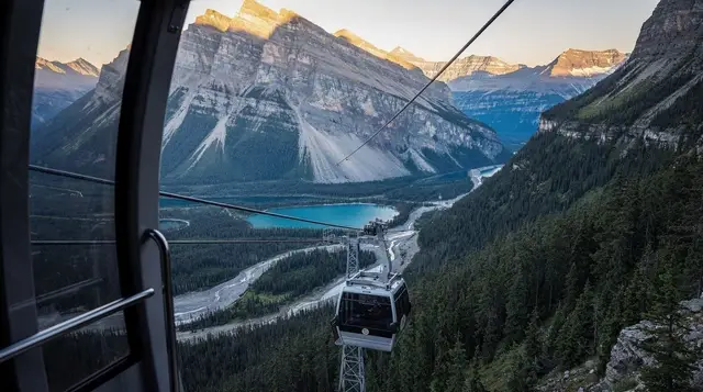
The Banff Gondola carries most visitors to the summit of Sulphur Mountain in about eight minutes, and for a lot of people that’s exactly the right call. This page isn’t about that ride, or the boardwalk, the restaurants, or the view deck at the top — those belong to the gondola itself as a paid attraction, and they’re covered elsewhere. This page is about the other way up: a real trail, on your own two feet, that climbs the same mountain from the same general base area and gets you to the same upper terminal near 2,281 metres, minus the ticket, plus a few hours of sustained climbing.
People choose the trail for different reasons. Some want the exercise and the sense of having earned the view rather than been delivered to it. Some are trying to keep a day’s budget down and are happy to walk one direction if it means paying for only a one-way gondola ticket instead of a return. Some just prefer trails to queues. Whatever the reason, the hike is a legitimate, well-used route — but it’s a longer and harder day than most of the postcard-easy hikes closer to the Banff townsite, and it deserves an honest look at distance, difficulty, and the points where people misjudge it.
The trail, by the numbers
| Metric | Figure |
|---|---|
| One-way distance | About 5.5 kilometres |
| Elevation gain | About 655 metres |
| Summit elevation | 2,281 metres |
| Typical climbing time | 2 to 3 hours |
| Typical descent time (on foot) | 1.5 to 2 hours |
| Trail surface | Packed dirt and gravel switchbacks, forested most of the way |
| Difficulty | Moderate — no scrambling, but sustained and largely unshaded near the top |
The trail starts at the base area near the gondola’s lower terminal on Mountain Avenue, close to the Banff Upper Hot Springs, and climbs in a long series of switchbacks through subalpine forest. It’s well-graded and easy to follow — this isn’t a route-finding challenge — but the elevation gain is real and sustained, without the flatter sections that break up some of the park’s other longer trails. Expect to be working the whole way, not strolling with occasional climbs.
For comparison, this is meaningfully more demanding than the classic short hikes people do straight out of town. Tunnel Mountain, the most popular quick outing in Banff, is 4.3 kilometres return with about 300 metres of gain — you’d do that entire hike, plus a bit more, just to match the elevation gain of Sulphur Mountain’s one-way climb.
If you’re looking for something shorter to test your legs first, or you’re travelling with someone who isn’t up for a multi-hour climb, the park’s easier and more accessible trails are a better starting point, and a broader look at hikes by difficulty puts Sulphur Mountain in context against the rest of the trail network.
What the climb actually feels like
The lower third is shaded, cool, and relatively gentle by the standards of what’s coming — a reasonable warm-up through forest that gives little hint of the effort ahead. The middle section is where the switchbacks tighten and the gain accelerates; this is the part that changes people’s minds partway up, and it’s worth knowing in advance rather than discovering it at kilometre three with tired legs and a schedule to keep.
The upper section thins out of full forest cover as you approach treeline, and this is both the best part of the hike for views back across the Bow Valley toward Mount Rundle and the part where weather starts to matter more than it did lower down. Wind picks up noticeably in the open sections near the top, temperatures drop with the elevation gain, and there’s less tree cover to buffer either. Hikers in shorts and a t-shirt at the trailhead regularly regret not packing a windproof layer by the time they’re within the last kilometre of the upper terminal.
Altitude plays a small but real role too. You’re gaining 655 metres to a summit above 2,200 metres, and even fit hikers who don’t live at elevation tend to feel their pace slow more than the raw numbers would suggest, particularly in the final push before the trail levels out near the top.
Combining the hike with the gondola
This is the detail that changes the whole equation for a lot of visitors: the gondola sells one-way tickets specifically for hikers. That means you don’t have to choose between “hike both ways” and “ride both ways” — you can climb under your own power and ride the gondola down, sparing your knees a descent that’s arguably harder on the joints than the climb is on the lungs, or you can ride up and hike down if you’d rather front-load the easy part and finish with a long, controlled descent.
Hiking down after already hiking up is also entirely possible and plenty of people do it, especially if the goal is the workout rather than convenience — budget an extra 1.5 to 2 hours for the descent on top of the climb, since tired legs move slower going down a sustained grade than the distance alone suggests. Whichever combination you pick, decide before you start rather than partway up, since ticket purchasing and hiker check-in for the one-way ride happen at the terminals, not mid-trail.
None of the gondola’s ticketing details, pricing tiers, or what’s waiting at the top — the boardwalk, the restaurants, the interpretive displays — belong on this page; a full comparison of the park’s gondolas and aerial rides covers that side of the experience if that’s what you’re after. What matters here is simply that the option to mix hiking and riding exists and is normal, not a workaround.
The Sanson’s Peak boardwalk isn’t part of the trail
One point of confusion worth clearing up directly: the boardwalk that leads out to the historic weather observatory at Sanson’s Peak is not something you pass on the way up the hiking trail. It starts from the upper terminal area at the summit — the same place the gondola arrives — meaning you only reach it once you’re already at the top, regardless of whether you got there by hiking or by riding. If your plan is to see the observatory and the boardwalk views specifically, you still need to complete the full climb (or the gondola ride) first; there’s no shortcut to it partway up the trail, and no version of this hike that reaches Sanson’s Peak without first reaching the summit proper.
Why this is not a casual winter hike
It’s tempting to look at a well-established trail with a gondola running year-round nearby and assume the hiking route stays just as approachable through the winter months. It doesn’t. The trail is not maintained as a cleared walking surface once snow sets in, ice builds up on the switchbacks — especially on sections that see partial sun and refreeze overnight — and the exposed upper stretch near treeline turns from a pleasant, breezy viewpoint in summer into a genuinely cold, wind-exposed slope in winter, where the effective temperature is well below whatever Banff townsite is reporting that day.
Attempting this route in winter without proper equipment — traction devices or crampons for the ice, poles for stability on the steeper switchbacks, and real wind-blocking layers for the exposed upper section — is a common way for an otherwise moderate summer trail to turn into a genuinely risky outing.
If your visit falls in the colder months and you still want the summit, taking the gondola up is the far more sensible option for most people; a full breakdown of what winter conditions in the Rockies actually mean is worth reading before you commit to any exposed trail this time of year, since this particular climb is a poor match for winter foot travel compared with routes built for the snow season.
Wildlife and trail etiquette
Sulphur Mountain sees heavy foot traffic for a forested trail, but that doesn’t remove the basics of hiking in bear country. Carrying bear spray is a sound default here as on any wooded trail in the park, and it’s worth remembering that bear spray can’t travel in checked or carry-on luggage on a flight — buy or rent a canister once you’ve arrived rather than assuming you can bring one from home.
Staying on the marked trail, making some noise on blind switchback corners, and giving any wildlife you do encounter plenty of space applies here the same as anywhere else in the park. For the fuller rundown on distances and what to actually do if you meet an animal, see the park’s bear safety and etiquette guide.
What to pack
| Item | Why |
|---|---|
| Layers, including a wind shell | Temperature and wind exposure both increase noticeably above treeline |
| Sturdy trail shoes or boots | Sustained grade on gravel and packed dirt switchbacks |
| Water, more than feels necessary | Little shade in the upper third, and no water source on the trail |
| Bear spray | Standard for any forested trail in the park |
| Cash or card for a one-way gondola ticket | If you plan to ride down (or up) rather than hike both ways |
| Traction device and poles, if hiking outside summer | The trail is not winter-maintained and ices over on the switchbacks |
Alternatives if you’d rather not manage the climb solo
Not everyone wants to tackle 655 metres of sustained elevation gain alone, and there are a few reasonable ways to experience this mountain and the surrounding forest without doing that specific climb unguided. A private guided nature walk covers gentler forested terrain in the same area with an interpreter setting the pace, which suits anyone who wants context on the landscape without committing to the full ascent. For a slower, more sensory way to spend time in the same forest the trail climbs through, a guided forest therapy session is built around the walk itself rather than reaching any particular summit.
If your visit falls in winter and the trail conditions described above have you reconsidering a solo attempt, a guided winter hikes and gondolas day trip pairs safer, guide-led winter routes with a gondola ride, which sidesteps the ice and exposure issues on this particular trail entirely. And for an entirely different way to experience Sulphur Mountain’s lower slopes without hiking boots at all, a four-hour intermediate horseback ride on Sulphur Mountain covers similar terrain from the saddle instead of on foot.
Sulphur Mountain hike versus the alternatives
| Option | Distance / gain | Effort | Best for |
|---|---|---|---|
| Hike up, hike down | 11 km round trip, 655 m gain each way | Strenuous, full day | Hikers wanting the complete effort and no ticket cost |
| Hike up, gondola down | 5.5 km, 655 m gain | Moderate | Most hikers — earns the summit, spares the knees |
| Gondola up, hike down | 5.5 km, 655 m loss | Moderate, easier on lungs | Those who want the descent workout without the climb |
| Gondola both ways | None on foot | None | Time-limited visits, mobility considerations, winter |
| Tunnel Mountain (comparison) | 4.3 km return, 300 m gain | Easy to moderate | A shorter warm-up or first mountain hike |
Planning the rest of the day around this hike
A full climb, even paired with a gondola ride down, is enough to anchor most of a morning or an afternoon rather than a quick stop between other plans. If you’re building a broader day around the Banff townsite, a one-day Banff itinerary shows where a climb like this fits alongside lower-effort stops, and the wider list of on-foot things to do in Banff puts it next to gentler options for anyone travelling as a mixed-ability group.
If your legs are done for the day once you’re back down, the Banff Upper Hot Springs sit close to the trailhead and are a genuinely well-matched way to finish — a comparison against Radium Hot Springs is worth a look if you’re deciding which soak to prioritize on a longer Rockies trip. For the full category of hiking and walking options around Banff beyond this single trail, see the hiking and walks hub.
Frequently asked questions about hiking Sulphur Mountain
How long and how difficult is the hike up Sulphur Mountain?
About 5.5 kilometres one-way with roughly 655 metres of elevation gain, climbing steadily through forest on a well-graded switchback trail. Most hikers take two to three hours going up. It’s rated moderate: no technical scrambling, but the sustained, unshaded climbing surprises people who expect something closer to a walk.
Can I hike up and take the gondola down, or the reverse?
Yes, and it’s the most common way to do this trail. The gondola sells one-way tickets specifically for hikers going in either direction, so you can climb on your own effort and ride down, or ride up and walk down if you’d rather have gravity working against your knees instead of your lungs.
Is the Sanson’s Peak boardwalk part of the hiking trail?
No. The boardwalk to the old weather observatory at Sanson’s Peak starts from the upper terminal at the top, past the point where the hiking trail and the gondola both arrive. You reach it only once you’re already at the summit area, whether you got there on foot or by gondola — it isn’t a landmark partway up the trail.
Can I hike Sulphur Mountain in winter?
Not casually, and not without proper gear. The trail is not maintained to a walkable standard through the snow season, ice forms on the switchbacks, and the upper section near treeline is exposed to wind that drops the effective temperature well below what the townsite is reporting. Crampons or traction devices, poles, and layered wind protection are the minimum; many visitors are better served taking the gondola up in winter rather than treating this as a snowshoe route.
Where does the Sulphur Mountain trail start?
At the base of the mountain near the gondola’s lower terminal on Mountain Avenue, a short drive or Roam Transit ride (route 1) from downtown Banff, close to the Banff Upper Hot Springs.
Do I need bear spray on this trail?
Carrying it is a sound default on any forested trail in the park, Sulphur Mountain included, even though it sees heavy foot traffic. Bear spray can’t travel in checked or carry-on luggage, so buy or rent a canister once you’re in Banff rather than trying to pack one from home.
How does hiking Sulphur Mountain compare to Tunnel Mountain?
Sulphur Mountain is the longer and considerably harder of the two: about 5.5 kilometres and 655 metres of gain one-way versus Tunnel Mountain’s 4.3 kilometres return and 300 metres of gain. Tunnel Mountain is the better choice for a short outing or a first mountain hike; Sulphur Mountain suits someone who wants a real climb and the option to ride down.
Does hiking up cost anything if I don’t use the gondola?
The trail itself is free to walk, as it sits within Banff National Park and only requires the Parks Canada pass everyone needs to be in the park at all. You only pay if you choose the one-way gondola ticket for the way down (or up).
Gondolas & mountain viewpoints on GetYourGuide
Verified deep-linked GetYourGuide tours. Book through these links and we earn a small commission at no cost to you.
GetYourGuide does not provide a product photo for this activity — the image shows the meeting point, photographed by us.