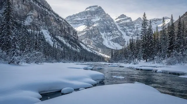
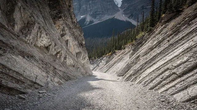
Where Kootenay National Park fits on the map
Kootenay National Park is the least-visited of the four national parks that make up the UNESCO-listed Canadian Rocky Mountain Parks, and it’s the one most visitors from Banff drive through rather than into. It sits in British Columbia, on the west side of the Continental Divide, and it’s cut through by a single highway: Highway 93 South, officially the Banff–Windermere Parkway, running from Castle Junction near Banff to the town of Radium Hot Springs.
That’s the whole park, in practical terms, for a day-tripper: one road, about 105 km long, with a handful of named stops along it. This page is the hub for that road and those stops. Each one has its own detailed page — Marble Canyon, the Paint Pots, Sinclair Canyon and Radium Hot Springs — so we won’t repeat their details here. What belongs on this page is orientation: where the park is, how it connects to Banff, what it costs, and which nearby names it gets confused with.
At 1,406 km², Kootenay is smaller than Banff and receives a fraction of its visitor numbers, largely because it has no headline lake to draw crowds the way Lake Louise or Moraine Lake do. What it offers instead is a scenic through-route: a way to see canyon geology, mineral springs and a mountain pass in the space of a single drive, on the way to somewhere else. Most visitors experience it exactly that way — as a corridor between Banff and the Columbia Valley — rather than as a standalone destination with its own overnight stay.
The single hard rule: don’t mix up Kootenay, Yoho and Kananaskis
Three place names sound similar enough, and sit close enough together on a map, that visitors regularly conflate them. They are not the same thing, and getting them wrong changes your pass, your route and your plans.
| Name | What it actually is | How you reach it from Banff | Pass required |
|---|---|---|---|
| Kootenay National Park | Federal national park, British Columbia | Highway 93 South from Castle Junction | Parks Canada day or annual pass |
| Yoho National Park | Separate federal national park, British Columbia | Trans-Canada Highway (Hwy 1) west, past Field | Parks Canada day or annual pass |
| Kananaskis | Provincial recreation land, Alberta | Highway 1 or Smith-Dorrien Trail, south of Canmore | Kananaskis Conservation Pass (provincial, unrelated) |
Kootenay and Yoho are both Parks Canada properties and both carry a Parks Canada pass, but they don’t share a road — you can’t drive from one into the other without backtracking through Banff or the Trans-Canada corridor. Kananaskis isn’t a national park at all. It’s Alberta provincial land, administered provincially, and it requires its own Kananaskis Conservation Pass — a Parks Canada pass does nothing there, and the Conservation Pass does nothing in Kootenay. If your itinerary has you buying “one pass for the whole trip,” check which pass covers which ground before you rely on it at a gate.
Getting there from Banff
The drive to Kootenay National Park starts at Castle Junction, about 30 km west of Banff on the Trans-Canada Highway, where Highway 93 South splits off toward British Columbia. From that junction, it’s roughly 105 km through the park to Radium Hot Springs, and the full run from Banff itself takes about 1 h 30 min if you don’t stop.
| Leg | Distance | Drive time |
|---|---|---|
| Banff to Castle Junction | About 30 km | 20–25 min |
| Castle Junction to Radium Hot Springs (through the park) | About 105 km | 1 h 05–1 h 15 min |
| Banff to Radium Hot Springs, total | About 135 km | About 1 h 30 min |
Add stops and that 1 h 30 min stretches quickly. Marble Canyon alone is a 20–30 minute walk from the parking area, and the Paint Pots trail is another 45 minutes to an hour round trip. Most people who actually want to see something along the way, rather than just cross the park, should budget a half-day for the drive with stops, and a full day if Radium Hot Springs is also on the list.
The road itself is a two-lane mountain highway with no unusual technical difficulty in summer, but it climbs over Vermilion Pass and Sinclair Pass, both of which see snow and ice outside the summer months. If you’re driving between October and April, check conditions before you go, and note that winter tires are legally required from October 1 to April 30 on British Columbia’s mountain highways, including this one — a rule that does not apply on the Alberta side of the border. Short closures for avalanche control or storm cleanup do happen on Highway 93 South in winter; they’re usually measured in hours, not days, but they’re worth checking if you’re travelling off-season with a tight schedule.
Fuel and cell coverage are both thinner here than on the main Trans-Canada corridor. There’s no fuel station directly on Highway 93 South between Castle Junction and Radium Hot Springs, so top up in Banff, Castle Junction or before you leave the Trans-Canada if you’re coming from the west. Mobile coverage is patchy for most of the drive and drops out entirely in the deepest parts of the valley, so download any maps or directions before you set out rather than counting on a live connection.
What’s actually in the park
Coming from Castle Junction, the stops line up roughly in this order:
- Vermilion Pass and the 1968 burn. The highway crests the Continental Divide here, in a stretch of forest shaped by a large 1968 wildfire — worth knowing about so the sparse, regrowing forest doesn’t read as neglect.
- Marble Canyon. A narrow limestone gorge with a short interpretive trail crossing back and forth over the creek on a series of bridges. It’s the shortest, most accessible stop in the park and usually the busiest.
- The Paint Pots. Cold mineral springs that stain the ground ochre red and yellow from iron oxide, reached by an easy trail from the same general area as Marble Canyon. Long used by Indigenous peoples, including Ktunaxa and Stoney Nakoda communities, for pigment.
- Numa Creek and the Rockwall. A quieter side valley favoured by longer-distance hikers and backpackers rather than day-trippers.
- Sinclair Canyon. A tight, red-walled cut in the rock that the highway passes directly through just before Radium, dramatic even from a moving car and the last landmark before the park’s western gate.
- Radium Hot Springs. Mineral hot pools at around 39°C, right at the park’s western gate, and the most obvious reason to make the drive a full outing rather than a pass-through. The townsite just outside the gate is also known for bighorn sheep that graze along the roadside, close enough to see from a slow-moving car — a reminder to keep the same distance rules that apply everywhere else in the Rockies.
None of these need a detailed breakdown on this page — they each have one of their own — but knowing the order and the rough time commitment of each helps with planning a single afternoon versus a full day.
If you’re weighing Radium against Banff Upper Hot Springs rather than planning to visit both, the short version is that they’re comparable in temperature and price but different in setting: Radium sits inside a canyon at the edge of a small BC town, Banff’s version sits on Sulphur Mountain with a view back toward the Bow Valley. Neither is a must-do over the other; it comes down to which fits your route.
The pass, and why it applies here too
Kootenay National Park is administered by Parks Canada exactly like Banff, Jasper and Yoho, which means the same Parks Canada pass system applies, and it applies even if you’re only driving through without stopping anywhere. As a rough order of magnitude, expect around 11 CAD per adult per day or about 22 CAD per vehicle per day, with an annual Discovery Pass running roughly 75 CAD per adult or 150 CAD per vehicle — always check the official current rate before you go, since these figures move year to year.
This catches people off guard on the Banff-to-Radium drive specifically, because the destination — Radium Hot Springs — sits just outside the park boundary in British Columbia, and it’s easy to assume the drive there is a normal provincial highway trip. It isn’t. The stretch between Castle Junction and the park’s western gate near Radium is entirely inside Kootenay National Park, so the pass is checked, and a vehicle without one can be ticketed at pay stations along the way.
Combining the drive with a guided option
Most of Kootenay National Park is easy enough to see independently — a rental car and a few hours are all the main stops require. For visitors without a vehicle, or who’d rather have commentary and logistics handled, a few guided options cover this corridor and the towns around it.
For a guided look that pairs Kootenay’s canyon scenery with Yoho’s landmark waterfall, a day trip built around Kootenay and Yoho national parks, including Canada’s second-tallest waterfall covers both parks in one outing without you needing to plan the routing yourself. If Radium Hot Springs is really the goal and you’d rather add an active stop nearby, a Golden Skybridge suspension bridge admission makes sense as an add-on for the town at the western end of this corridor.
Golden is also the base for a four-hour whitewater rafting run on the Kicking Horse River, a common half-day addition for anyone continuing past Radium rather than turning back to Banff. And for hikers who want a guided route into the park’s quieter interior rather than the roadside stops, a guided hike up Numa Creek reaches terrain that most day-trippers never see.
Planning it as a day trip from Banff
Kootenay National Park works best as a half-day or full-day outing from Banff rather than a base to stay in — there’s very little overnight accommodation inside the park itself, and most visitors sleep in Radium, Invermere, Golden or back in Banff and Canmore. A typical plan looks like a morning drive out via Castle Junction, an hour or two split between Marble Canyon and the Paint Pots, a soak at Radium Hot Springs in the afternoon, and a return drive to Banff by evening, or an onward drive to Golden if that’s next on the itinerary.
It pairs naturally with a wider loop through the Columbia Valley region — Radium and Golden sit close enough together that combining Kootenay with a stop at the Golden Skybridge or a run on the Kicking Horse River is a common way to fill a fuller day. It’s a poor fit, on the other hand, for anyone trying to squeeze it into the same day as Lake Louise or Moraine Lake — the driving alone, before any stops, already accounts for a meaningful chunk of a day, and stacking two major outings on top of it usually means rushing both.
If a rental car isn’t part of your trip, this corridor is harder to piece together with public transit than the Banff–Lake Louise stretch, since there’s no scheduled shuttle or transit route along Highway 93 South. That’s the main reason most visitors see Kootenay as part of a guided day trip or a self-driven loop rather than a stop reached independently by bus.
Kootenay National Park, questions answered
Is Kootenay National Park the same as Yoho National Park?
No. They’re separate national parks that both sit in British Columbia and both border Banff, but they’re reached by different highways. Yoho is north of Banff along the Trans-Canada Highway (Field, Emerald Lake, Takakkaw Falls). Kootenay is reached from Banff via Highway 93 South, and the two parks don’t connect to each other by a through road.
Does the Kananaskis pass work in Kootenay National Park?
No. Kananaskis is a provincial recreation area in Alberta with its own Kananaskis Conservation Pass, which has nothing to do with the federal park system. Kootenay is a national park, so it takes a Parks Canada pass, the same one that covers Banff, Jasper and Yoho.
How long does it take to drive from Banff to Radium Hot Springs through Kootenay National Park?
About 1 h 30 min for the roughly 105 km drive on Highway 93 South, not counting stops. Add time for Marble Canyon, the Paint Pots and Sinclair Canyon if you want to see them on the way, which easily turns the drive into a half-day or full-day outing.
Do I need a separate pass to drive through Kootenay National Park?
Yes. Kootenay is a national park like Banff, Jasper and Yoho, so the same Parks Canada day pass or annual Discovery Pass applies, checked at park gates and pay stations. It’s roughly 11 CAD per adult or 22 CAD per vehicle per day, and it’s required even if you’re only driving through without stopping.
What’s the one thing people confuse about Kootenay National Park?
Mixing it up with Kananaskis. Kootenay is a federal national park under Parks Canada, reached from Banff by Highway 93 South. Kananaskis is provincial land in Alberta with a different pass and a different administration, and it’s reached from a different direction entirely. The names sound similar; the parks, passes and routes are not.