Most visitors driving Kootenay National Park for the first time expect Marble Canyon to take up half an afternoon. It doesn’t. The interpretive loop that crosses Tokumm Creek’s gorge is about 800 m return, flat enough for most fitness levels, and done in 30 to 45 minutes for anyone who isn’t rushing. What it delivers in that short distance is disproportionate: a narrow limestone slot, polished pale by centuries of fast water, crossed by a run of footbridges that put you almost directly over the current.
Where Marble Canyon sits and how to get there
Marble Canyon is on Highway 93 South, the Kootenay Parkway, a short drive past the Kootenay National Park boundary from the Trans-Canada Highway junction near Castle Junction. From Banff, the drive is about 105 km and takes roughly 1 h 20 min, running west on Highway 1 before turning south onto Highway 93. It’s a straightforward, well-paved road with no unusual driving hazards, and it makes an easy half-day loop combined with Radium Hot Springs or a longer swing toward Golden.
The trailhead has its own small parking lot directly off the highway, clearly signed. A valid Parks Canada pass is required for the whole of Kootenay National Park, including a stop here that takes less than an hour — the pass covers the park, not individual trailheads, so don’t assume a short visit is exempt.
| From | Distance | Drive time |
|---|---|---|
| Banff | ~105 km | ~1 h 20 min |
| Lake Louise | ~90 km | ~1 h 10 min |
| Radium Hot Springs | ~30 km | ~25 min |
| Golden | ~90 km | ~1 h |
The canyon and the walk
Tokumm Creek carries glacial meltwater down from the high country above, and over thousands of years it has cut a slot through limestone and dolomite bedrock, narrow enough in places that you can nearly reach across it. The rock has been scoured smooth and pale, which is where the “marble” name comes from, even though it isn’t true marble in the geological sense — it’s limestone, worn glassy by fast water rather than metamorphosed by heat and pressure.
The loop trail follows numbered stops tied to an interpretive guide, explaining the geology and hydrology as you go. It crosses the gorge repeatedly on narrow footbridges, and this is really the heart of the experience: standing on a bridge only a metre or two wide, looking straight down into a channel that in places drops considerably below your feet, with white water churning through it. The far end of the loop reaches a waterfall where the creek pours into the gorge, before the trail loops back toward the parking lot.
There’s no real elevation gain worth planning around. Footing is generally good, though the rock near the bridges can be damp from spray, and rails are present at the viewpoints but the drop beyond them is genuinely deep in several spots — treat it with the same caution you’d use at Johnston Canyon or Maligne Canyon.
The trap: short trail, slow crowd
Here’s the part an itinerary built purely on distance gets wrong. At 800 m return, Marble Canyon reads like a 20-minute stop. In practice, July and August afternoons routinely stretch that to 45 minutes or more, and the reason has nothing to do with trail length — it’s the bridges. Only so many people can cross a narrow footbridge at once, especially with visitors stopping to take photos of the gorge below, and a modest crowd is enough to back the line up at each crossing. The small parking lot fills early too, often by mid-morning on peak summer days, with no real overflow area nearby. Budget more time than the distance suggests, and consider an early-morning or later-afternoon visit if your schedule allows it.
If you’d rather not manage the driving and timing yourself, a guided day trip through Kootenay covers Marble Canyon alongside Emerald Lake in one outing, which removes the parking-lot guesswork entirely.
Marble Canyon and the Paint Pots
A few minutes’ further drive south on Highway 93 brings you to the Paint Pots trailhead, and the two make an obvious pairing on the same stop. The Paint Pots are a set of ochre-coloured mineral springs, coloured by iron oxide in the groundwater, reached by a flat, easy walk across a footbridge over the Vermilion River. Indigenous peoples in the region historically gathered ochre from springs like these to make pigment for paint, a use that predates the road and the park by a long stretch of time.
The walk to the Paint Pots takes about 15 to 20 minutes each way and asks nothing of you in the way of fitness. Visiting both on the same stop — Marble Canyon first, Paint Pots second, or the reverse — is the efficient way to see the two most distinctive short walks on this stretch of Highway 93 without doubling back later.
Building it into a Kootenay day
Marble Canyon rarely stands alone on an itinerary; it’s almost always one stop on a longer loop through Kootenay National Park. A common pattern from Banff runs west on Highway 1, south on Highway 93 past Marble Canyon and the Paint Pots, on to Radium Hot Springs for a soak, then either back the way you came or north to Golden before returning via the Trans-Canada. The full loop makes a comfortable full day, with Marble Canyon and the Paint Pots together taking up under two hours of it.
| Stop | Approx. time needed |
|---|---|
| Marble Canyon loop | 30-45 minutes |
| Paint Pots | 15-20 minutes |
| Radium Hot Springs soak | 1-2 hours |
| Driving (Banff-Radium loop) | 3-3.5 hours total |
Timing the loop around the middle of the day rarely works well in peak season — that’s when both the parking lot and the bridges are at their busiest. An early start from Banff, reaching Marble Canyon before mid-morning, gets you a quieter trail and an easier time finding a parking spot, with the rest of the loop to follow at a relaxed pace once the short walk is done.
For visitors who’d rather have the whole Kootenay loop planned and driven for them, a guided option covering Kootenay National Park as a day trip handles the routing, and one built around Marble Canyon alongside Emerald Lake and the rest of Yoho stacks two national parks into a single day if that fits your schedule better.
A broader circuit adding Peyto Lake and the Columbia Icefield to the same day is the most ambitious version, best suited to visitors who don’t mind a long day in the vehicle.
What the rock is actually doing
The gorge didn’t form overnight, and it isn’t finished forming. Tokumm Creek runs cold and fast off the surrounding peaks, carrying a steady load of fine sediment that acts like liquid sandpaper against the limestone bed. Limestone dissolves slowly in slightly acidic water too, so the creek is cutting the channel by both mechanical abrasion and chemical erosion at once, which is part of why the walls look so smooth and rounded rather than jagged. In a handful of spots the gorge narrows enough that the creek is barely visible from directly above — you hear it echoing off the rock well before you can see the water itself, which is arguably the most striking single moment on the walk.
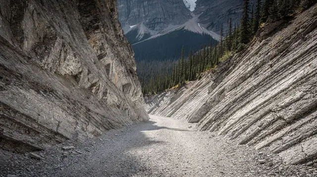
The depth varies considerably along the loop. Near the trailhead the drop is modest; by the midpoint, where the canyon is at its narrowest, the walls plunge much further, and the exposed rock shows visible banding from the different mineral layers that make up the limestone and dolomite. None of this requires a geology background to appreciate — the interpretive signage along the route explains the process in plain terms, and the visual evidence is on the surface of the rock itself.
Practical notes for the visit
Footwear matters more here than the short distance suggests. The trail surface is generally packed gravel and boardwalk, easy walking in ordinary shoes, but the areas right around the bridges pick up spray from the creek below and stay damp even on dry days — wear shoes with real grip rather than smooth-soled sandals. There’s no food or water service at the trailhead, so bring what you need; the nearest options are back toward Radium Hot Springs or up toward Lake Louise, not at the site itself.
Cell coverage along this stretch of Highway 93 South is inconsistent, so it’s worth downloading or screenshotting any directions before you leave cell range near the Trans-Canada junction. Washrooms are available at the trailhead parking area. The walk works in light rain, since most of it is on boardwalk or firm gravel, but the bridge surfaces get slick, so slow down and use the handrails if the weather turns while you’re out.
Photographers get the most dramatic results at the two or three bridge crossings where the gorge is narrowest and deepest, looking straight down the channel rather than across it. Overcast light actually works better than harsh midday sun here, since direct sun creates hard shadows inside the gorge that flatten the sense of depth in photos; a soft, even sky brings out the banding in the rock walls more clearly. Early morning also means a quieter trail and fewer people crossing the same bridge as you’re trying to frame a shot.
Nearby stops worth combining
Kootenay National Park’s other short walks sit within easy reach of Marble Canyon on the same highway. The Paint Pots trailhead is the closest and most natural pairing, but the park also includes Sinclair Canyon and the hot springs complex near Radium, and further north, the Yoho National Park sites around Field — Emerald Lake, Takakkaw Falls, and the Natural Bridge — extend a Kootenay day into a two-park loop for visitors with a full day to spend.
Marble Canyon: frequently asked questions
How long is the walk at Marble Canyon?
The full interpretive loop is about 800 m return and takes most people 30 to 45 minutes, including stops at the numbered viewpoints and bridges. There’s no real elevation gain to speak of, but the bridges are narrow, so the walk often takes longer than its short length suggests once other visitors are on the trail with you.
Why is it called Marble Canyon if the rock is limestone?
The rock is limestone and dolomite, not true marble, but centuries of fast-flowing water from Tokumm Creek have polished the walls smooth and pale enough that early visitors named it for the resemblance. The name stuck even though geologists would call it a limestone gorge rather than a marble one.
How many bridges cross Marble Canyon?
The loop crosses the gorge on a series of narrow footbridges, with numbered stops corresponding to an interpretive trail guide, so you’re looking almost straight down into the water and the fluted rock walls at several points along the walk. The bridges are the main reason the trail bottlenecks in peak season — only so many people can be on one at a time.
Is Marble Canyon busy, and where do you park?
Yes, the trailhead parking lot is small and fills up by mid-morning on summer weekends, well before the short walk itself would suggest a problem. The bottleneck isn’t really the trail length, it’s the narrow bridges: even a modest crowd slows to single file crossing them, so a stop that should take 30 minutes can stretch out considerably at peak hours. Arriving early or late in the day, or simply budgeting extra time, is the realistic plan for July and August.
Can you continue past Marble Canyon to the Paint Pots?
Yes, and it’s worth doing. The Paint Pots trailhead is a few minutes’ drive further along Highway 93 South, and it’s a flat, easy walk to a set of ochre-coloured mineral springs that Indigenous peoples used historically to source pigment for paint. Treating the two as one combined stop is the efficient way to see both without doubling back.
Is Marble Canyon suitable for kids?
Generally yes, since the trail is short, mostly flat, and well maintained, but the bridges have railings while the canyon drop below them is genuinely deep in places. Keep a firm hand on children at the viewpoints and don’t let them lean over the rails, especially when the trail is crowded and people are trying to pass each other.
Is there an entrance fee for Marble Canyon?
There’s no separate ticket for the trail itself, but you need a valid Parks Canada day pass or Discovery Pass to be anywhere in Kootenay National Park, including a short stop at the Marble Canyon lot. Check the current official rate before you go rather than assuming last year’s price.
How does Marble Canyon compare to Johnston Canyon near Banff?
Marble Canyon is much shorter, at about 800 m return against Johnston Canyon’s 2.7 km to the upper falls, and it’s built around bridges crossing the gorge rather than a catwalk running alongside it. Johnston Canyon draws far bigger crowds simply because it’s closer to Banff townsite; Marble Canyon’s smaller, more remote parking lot means it never gets quite as packed, though the narrow bridges still create their own bottleneck in summer.