Most people driving the Icefields Parkway toward Jasper have heard of Maligne Lake and assume Maligne Canyon is the same stop, or a warm-up for it. It isn’t. The canyon is its own destination — a narrow limestone gorge a short drive from Jasper townsite, threaded by a network of trails and six bridges that let you look down into water carved rock from progressively more dramatic angles. Maligne Lake is a separate place, 45 minutes further along the same road, and it gets its own page on this site.
What makes the canyon worth planning around is how differently it reads by season. In summer, it’s a walk — waterfalls, potholes, and in dry years stretches of exposed streambed where the river has gone underground. In winter, the same gorge freezes into a corridor of blue-white ice, and the only responsible way to see it is on a guided walk with crampons supplied. Treating that winter visit as a casual, unguided stroll is the mistake that gets people hurt here.
A narrow gorge, not the lake of the same name
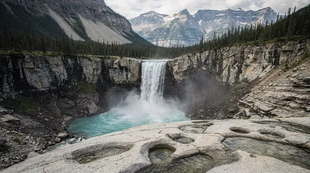
The Maligne River carved this canyon through limestone bedrock, and in places the gorge narrows to just a few metres across while dropping over 50 metres deep — narrow and deep enough that the roar of water below carries up to the bridges well before you can see it. A short paved path from the parking lot leads to the first bridge, and from there the trail follows the canyon rim, crossing back and forth over six numbered bridges that each show a different stretch of the gorge.
It sits close to Jasper townsite, not deep in the backcountry, which is part of its appeal — a genuinely dramatic landscape reachable in a few minutes from a parking lot rather than after a long approach hike. That accessibility is also why it draws a steady stream of visitors through the summer, though nowhere near the volume that piles up at Banff’s most photographed lakes.
Getting there from Banff
Maligne Canyon sits about 300 km from Banff, which works out to roughly 3 hours 45 minutes to 4 hours of driving, almost all of it along the Icefields Parkway through Jasper townsite and then a short stretch out Maligne Lake Road. That’s not a distance to treat lightly — see our complete Icefields Parkway guide and our stops-in-order guide for what else sits along the way, and our gas and cell coverage guide before you go, since services are thin along most of the route.
There’s no shuttle running from Banff out to the canyon. In practice, this stop belongs to a Jasper-based visit rather than a Banff day trip — trying to fold Maligne Canyon into a single day out of Banff alongside the Columbia Icefield and Jasper itself is the kind of plan that looks fine on a map and falls apart on the road. Our guide on why one day in Jasper is too short walks through why, and our four-day Banff-to-Jasper itinerary lays out a version that actually has room for it.
A Parks Canada day pass is required here the same as anywhere in the mountain parks; see our Parks Canada pass guide for current rates before you set out.
The six bridges: what each one actually shows you
The trail system is built around six numbered bridges, each crossing the canyon at a different point and offering a different view of the gorge below. You don’t have to do all six — most visitors turn back after the second or third, where the canyon is at its most dramatic, and the crowd thins out fast past that point.
| Bridge | Approx. distance from parking lot | What you see |
|---|---|---|
| First bridge | About 400 m | Wide view near the canyon mouth, first falls |
| Second bridge | About 600 m | The canyon’s narrowest, deepest point |
| Third bridge | About 1 km | Potholes carved into the rock, less crowded |
| Fourth bridge | About 1.1 km | Where most visitors turn back |
| Fifth bridge | About 2.6 km | Canyon widens, quieter forested stretch |
| Sixth bridge | About 3.7 km (loop) | Old fire road loop back to the parking lot |
The short loop to the fourth bridge and back runs about 2.2 km round trip and takes roughly an hour at an easy pace — enough to see the canyon at its narrowest without committing to a long walk. Continuing to the sixth bridge and looping back along the old fire road brings the full outing to about 3.7 km and 1.5 to 2 hours, and rewards you with a much quieter stretch of forest and a wider, calmer section of river well past where the crowd from the parking lot ever reaches.
Why the canyon runs dry in places by late summer
One detail that surprises first-time visitors: parts of the upper canyon can look nearly dry by August in a low-water year. The Maligne River disappears underground for a stretch through a karst system of sinkholes and cave passages, then resurfaces further down — a genuine geological curiosity, not evidence that something’s wrong with the river. Depending on the year and the month, you might see the canyon running full its whole length, or catch stretches near the upper bridges reduced to a trickle over bare rock.
Spring and early summer, once the winter ice has fully cleared, tend to show the fullest water. By late summer the display can be less dramatic at the upper bridges, though the deepest, narrowest section around the second bridge generally keeps enough flow to stay impressive regardless of the month.
Winter: a completely different canyon, and this is where a guide matters
From roughly December through March, the canyon freezes into a corridor of ice — curtains of blue-white ice built up against the limestone walls, frozen waterfalls, and ice formations that don’t exist at any other time of year. It’s a genuinely different sight from the summer walk, and one of the more distinctive winter experiences near Jasper.
Here’s the part to take seriously: walking along the rim to the first couple of bridges is one thing, generally manageable independently with ice cleats since it stays close to the parking lot. Getting down onto the canyon floor itself, where the ice formations actually are, is a different undertaking entirely. That section is icy, uneven, and exposed to conditions that change through the season — not a place to improvise your way into without current local knowledge. Any guide, blog, or itinerary that frames the winter canyon floor as a casual, unguided stroll is giving you bad advice, and this page won’t do that.
A guided ice walk is the way this is actually done. A guide leads a small group down onto the frozen creek bed, between the canyon walls, past the ice curtains and frozen falls, typically over 2 to 3 hours. Crampons are supplied, sometimes a headlamp too, and the guide knows which sections of ice are currently solid and which to avoid — information that changes through the winter and isn’t something a visitor can assess on sight.
If a Maligne Canyon or nearby ice walk fits your winter plans, our comparison of the region’s guided ice walks lines up what’s on offer between here and Johnston Canyon back near Banff, and our own trail-by-trail canyon guide goes into more depth on both seasons.
Dress for a shaded gorge that runs noticeably colder than the open valley — standing around to look at ice formations means standing still in the cold longer than a normal winter walk would. Check our winter driving guide for the Rockies before making the drive out from Jasper, since the access road isn’t always plowed to bare pavement.
Combining Maligne Canyon with the rest of a Jasper day
Because the canyon sits close to Jasper townsite and directly on the way to Maligne Lake, it fits naturally into a longer day rather than standing alone as a destination worth a dedicated trip from Banff. A guided option that handles the whole loop is a tour from Jasper covering Maligne Canyon, Maligne Lake, and Medicine Lake in one outing, which removes the need to plan the stops and the driving yourself.
If your day is built more around the Icefields Parkway side of things, the canyon pairs reasonably well with a Columbia Icefield stop on the way back south — a guided glacier hike out onto the Columbia Icefield or a Columbia Icefield and Glacier Skywalk outing from Jasper both work as a second stop the same day, since both sit along the same stretch of highway you’re already driving. None of this makes a single day out of Banff realistic for all of it — see the itinerary note above — but it does make sense as one full day based out of Jasper itself.
What sits nearby, and what doesn’t belong on this page
A few other stops sit close enough to Maligne Canyon to be worth knowing about, even though this page isn’t the place to cover them in depth. Maligne Lake itself, further along the same road, is where the boat cruise and its own set of views live — a genuinely separate visit with its own planning questions.
Back toward Jasper townsite, the Jasper SkyTram and Athabasca Falls both make sense as same-day pairings if you’re building out a fuller Jasper itinerary. And if you’re weighing whether to visit Jasper at all after the July 2024 wildfire, our honest guide to Jasper after the fire covers what’s changed and what hasn’t.
When to go
June through September gives you the full summer trail network and the best odds of seeing water running the whole canyon length, though a dry August can thin out the upper stretches. Shoulder months (May, October) can still work for the rim trail but bring a real chance of ice or snow on the paths without any of the organized winter infrastructure in place yet.
December through March is when the ice walk becomes the reason to come, and it’s worth planning around a guided departure rather than showing up and hoping to improvise something. If wildlife and the dark sky preserve are also on your list for a Jasper stay, an autumn visit lets you combine the canyon with stargazing season before winter access changes the visit entirely.
Practical basics
| Item | Detail |
|---|---|
| Parking | Lot at the trailhead, small restaurant nearby, fills on summer weekends |
| Pass required | Yes, Parks Canada day pass or annual Discovery Pass |
| Facilities | Washrooms and a café at the parking lot; nothing past the first bridge |
| Cell coverage | Patchy to none past the parking lot |
| Dogs | Allowed on leash on the summer trail |
| Winter canyon floor | Guided ice walk only — not a self-guided route |
Bear activity is reported in this area like most of the park’s forested trails; carry bear spray on the longer loop past the fourth bridge, and review our bear safety guide before setting out, particularly if you’re doing the quieter stretch toward the fifth and sixth bridges where sightlines are shorter and foot traffic drops off.
Maligne Canyon: frequently asked questions
What is Maligne Canyon, and is it the same as Maligne Lake?
No. Maligne Canyon is a narrow limestone gorge a short drive from Jasper townsite, with a network of trails and six bridges. Maligne Lake is a separate destination about 45 minutes further along the same road, best known for its boat cruise. They share a name because the same river connects them, but they’re two different stops with two different visits.
How long is the Maligne Canyon walk?
The short loop to the fourth bridge and back is roughly 2.2 km round trip, doable in an hour at an easy pace. The full loop out to the sixth bridge and back along the old fire road runs closer to 3.7 km and takes 1.5 to 2 hours. Most visitors turn back at the second or third bridge, where the canyon is at its narrowest and most dramatic.
Can you visit Maligne Canyon in winter without a guide?
The upper trail down to the first couple of bridges is generally walkable independently with ice cleats, since it stays close to the parking lot. Getting down into the canyon floor itself to see the ice formations is a different matter — that section is icy, exposed, and not something to attempt without a guide who knows current conditions. Treat any suggestion of an unguided canyon-floor walk in winter as bad advice.
What does a guided ice walk at Maligne Canyon involve?
A guide leads a small group down into the canyon itself, walking on the frozen creek bed between the limestone walls, past ice curtains and frozen waterfalls built up over the winter. Crampons and sometimes a headlamp are supplied. Tours typically run 2 to 3 hours and depart from Jasper; dress for standing around in a shaded gorge, which runs colder than the open valley.
Why is part of the canyon dry by late summer?
The Maligne River partly disappears underground through a karst system of sinkholes and cave passages upstream, then resurfaces lower down. In wetter years and earlier in summer the canyon runs full for most of its length; by late August in a dry year, stretches of the streambed near the upper bridges can run low or expose bare rock. It’s a normal feature of this kind of limestone landscape, not a sign anything is wrong.
How do you get to Maligne Canyon from Banff?
It’s about 300 km, roughly 3 hours 45 minutes to 4 hours, driving the Icefields Parkway north through Jasper townsite and then out along Maligne Lake Road. There’s no direct shuttle from Banff — most visitors either stay overnight in Jasper or join a tour that includes the canyon as one stop on a longer day.
Is Maligne Canyon worth doing if you’re already stopping at Maligne Lake?
Yes, since the canyon is directly on the way to the lake and adds only a short detour. Pairing them in one outing is the normal way to see both — a guided option that bundles the canyon with the lake and Medicine Lake removes the need to plan the stops yourself.
Is Maligne Canyon suitable for kids?
The first two bridges work well for most kids, with a wide path and railings at the viewpoints. Past the third bridge the trail narrows and some sections sit close to unrailed drops into the gorge, so keep a hand on younger children there. In winter, the guided ice walk companies generally set a minimum age, so check before booking with young kids.