Johnston Canyon and the Ink Pots: the complete hike guide
Is Johnston Canyon an easy hike?
The lower falls, 1.1 kilometres one-way, are an easy paved and boardwalk walk. But the trail runs on steel catwalks bolted to the canyon wall, and those catwalks ice over from roughly October through May. Traction devices are recommended outside summer, and the upper falls (2.7 kilometres) and Ink Pots (5.8 kilometres) add real distance and a steadier climb.
What the trail actually involves
Johnston Canyon sits on the Bow Valley Parkway, the old highway 1A that runs between Banff and Lake Louise, and it is one of the busiest short hikes in Banff National Park. The reason is straightforward: a limestone canyon carved by Johnston Creek, two waterfalls reachable on foot within a couple of hours, and — for those who keep going — a set of cold mineral springs called the Ink Pots at the far end.
The catch is in how you reach any of it. Much of the route runs on steel catwalks and boardwalks bolted directly to the canyon wall, suspended a few metres above the creek. That construction is what makes the lower falls accessible to almost anyone in summer. It is also what makes this a genuinely different hike in winter and shoulder season, when spray off the creek freezes onto the same metal decking. This page treats those two realities as one trail, not a “pretty walk” you can do the same way every month of the year.
This guide covers the lower falls, the upper falls, and the extension to the Ink Pots. It does not cover Marble Canyon in Kootenay National Park or Maligne Canyon near Jasper — both are separate canyons in separate parts of the Rockies, and each has its own page.
Distances, in one-way trailhead numbers
Parks Canada signage marks distances one-way from the trailhead, and that is the convention below. Double each figure for the round trip you will actually walk unless you turn back early.
| Segment | One-way distance | Round trip | Surface |
|---|---|---|---|
| Trailhead to lower falls | 1.1 km | 2.2 km | Paved path, then a steel catwalk along the canyon wall |
| Lower falls to upper falls | 2.7 km total | 5.4 km | Forest trail, then a steeper catwalk climb to the upper viewpoint |
| Upper falls to the Ink Pots | 5.8 km total | 11.6 km | Forest and open meadow trail, a steady but moderate climb |
Budget 30 to 45 minutes round trip for the lower falls alone, 1.5 to 2 hours round trip if you continue to the upper falls, and 3 to 4 hours round trip for the full walk to the Ink Pots. Add time for photography and for the inevitable slow shuffle past other hikers on the narrower catwalk sections — this is not a trail where you set your own pace in July.
The lower falls (1.1 km)
The walk to the lower falls is the one most day-trippers from Banff actually do, and on paper it is easy: a paved path for the first stretch, then a catwalk bolted into the rock that carries you along the canyon wall with the creek churning below. Near the end, a short tunnel through the rock leads to a viewing platform a few metres from the base of the falls, close enough to feel the spray on a warm day.
The trade-off for that easy access is crowding. This section can bottleneck badly at midday in July and August — the catwalk is narrow, there is nowhere to pass on the tighter turns, and a slow-moving group ahead of you sets your pace whether you like it or not. If a quick, low-effort walk from Banff is the goal, this segment delivers it, but arrive early or late to actually enjoy it rather than queue for it.
The upper falls (2.7 km)
Past the lower falls, the trail leaves the crowds behind in noticeably smaller numbers, climbs more steadily, and reaches a second catwalk section leading to the upper falls viewpoint. The upper falls are taller and, most days, quieter than the lower falls — worth the extra distance if you have the legs and the time. The catwalk here is steeper and narrower in places than the lower section, which matters more in winter than in summer.
Many visitors turn around at the upper falls, which is a reasonable stopping point if your day also includes Lake Louise or Moraine Lake and you are trying to keep the morning manageable. If you have another two to three hours, the best part of the trail — the part with actual quiet — is still ahead.
The Ink Pots (5.8 km)
Past the upper falls, the trail leaves the catwalks and the canyon behind entirely. It climbs through forest before opening into a wide subalpine meadow with views toward the Sawback Range, and this is where most of the crowd from the lower falls has already turned back. The Ink Pots themselves are a cluster of small, spring-fed pools with a constant temperature that keeps them from freezing even in winter — the sand on their beds visibly bubbles as mineral-rich water pushes up from below, which is the entire appeal and the reason the name has stuck.
There is no facility at the Ink Pots — no washroom, no food, no cell coverage to count on. Pack out what you bring in, and treat the meadow as a place to sit and eat lunch rather than a destination with amenities. The contrast with the crowded lower falls, twenty or thirty minutes back down the trail, is the main reason to make the full trip rather than stopping at the upper falls.
Catwalks, ice, and why this isn’t a summer-only trail
The single most important thing to know about Johnston Canyon, and the thing that trips up visitors who arrive expecting a boardwalk stroll: the catwalks that make this trail accessible in summer become a hazard in colder months. Spray from the creek settles onto the metal decking and handrails and freezes, and that ice does not always look obvious underfoot, especially in shaded sections of the canyon that see little direct sun.
Roughly October through May, expect ice on at least part of the route, and plan for it rather than discovering it partway up a catwalk. Strap-on ice cleats — the kind sold in outdoor shops in Banff and Canmore — make a real difference on the steeper stretches near the upper falls. Trekking poles help with balance on the flatter but still slick lower sections. None of this is optional gear in December or January; it is closer to mandatory.
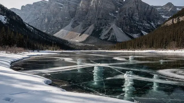
For anyone who would rather not bring or rent cleats and figure out the icy sections alone, a guided ice walk to the frozen lower falls supplies traction devices, keeps the pace sensible for the conditions, and adds context on the canyon’s geology that a solo winter visit tends to skip. It is a genuinely different experience from the summer version of this hike — the falls themselves freeze into ice columns — not simply a colder rerun of the same walk.
Crowds and timing
Johnston Canyon draws a disproportionate share of Banff’s day-trip traffic because it delivers a real payoff for very little effort — at least as far as the lower falls. That popularity means the trailhead parking lot fills early, the lower falls catwalk bottlenecks at midday, and the whole experience improves sharply if you shift your visit outside the 10 a.m. to 4 p.m. window in July and August.
Early morning is the more reliable option: light is better for photos in the canyon’s shaded sections, the parking lot still has spaces, and the lower falls catwalk is passable rather than queued. Shoulder season — May, June, September, and October — thins the crowds considerably, though that is exactly the window where ice is most likely to be present without necessarily being expected, so check current trail conditions before assuming a spring or fall visit means dry catwalks.
Getting there and parking
Johnston Canyon has its own trailhead parking lot directly off the Bow Valley Parkway, roughly midway between Banff and Lake Louise. In peak summer that lot typically fills by mid-morning, after which vehicles queue on the shoulder or move on to try again later. Roam Transit’s routes cover Banff, Canmore, Lake Minnewanka, Sulphur Mountain, Tunnel Mountain, and Lake Louise, but none of them run to Johnston Canyon — a private vehicle, taxi, or an organized tour is the only practical way to reach the trailhead without a car of your own.
One seasonal wrinkle worth checking before a spring visit: the eastern stretch of the Bow Valley Parkway closes to vehicles from March 1 to June 25 each year to protect wildlife during a sensitive period. Whether that closure affects vehicle access to the Johnston Canyon turnoff specifically can vary by year, so confirm current signage or Parks Canada’s posted parkway status rather than assuming either way if you are planning a late-spring drive.
Guided options and what they add
A rental car and a printed map are enough for the lower and upper falls in summer. Where a guided option earns its cost is winter traction and route knowledge, or when Johnston Canyon is one stop among several and you would rather not do the driving and timing yourself.
A guided hike to the Ink Pots is the closest match to doing the full trail independently, with the benefit of a guide setting a realistic pace for the 11.6-kilometre round trip and pointing out what the meadow and the pools actually are.
For a day that combines this canyon with other Bow Valley stops in one booking, a half-day tour pairing Johnston Canyon with the Banff Gondola, Cave and Basin, and Lake Minnewanka covers more ground than a self-driven morning would comfortably allow. And for visitors splitting time between Banff and Lake Louise, a day tour linking Johnston Canyon with Lake Louise and Emerald Lake removes the parking-lot math entirely, at the cost of a fixed schedule rather than your own.
None of these are necessary for a straightforward summer visit to the lower falls — that part of the trail is genuininely simple to do on your own. They earn their price when winter ice, a packed itinerary, or the lack of a car changes the calculation.
Where this fits in a Banff visit
Johnston Canyon works well as a half-day add-on rather than a full day’s plan by itself, which is exactly why it turns up on so many combination tours. If you are hiking it independently, it pairs naturally with a visit to Mount Norquay the same day, since it adds little driving time from the Bow Valley Parkway. For a broader look at where Johnston Canyon ranks against Banff’s other short walks, see our roundup of Banff’s best day hikes by difficulty, and for trails that skip the catwalks and the crowds entirely, our list of easy, accessible trails around Banff is a useful comparison.
Anyone building a longer stay should check our multi-day hiking itinerary for Banff, which sequences Johnston Canyon alongside other trails rather than trying to fit everything into one overloaded day. Winter visitors planning around ice and daylight should also read our guide to winter driving in the Rockies before committing to a full day outdoors in the colder months.
Wildlife is a real consideration here, not a formality — this is bear country, and the bear safety guide covers carrying bear spray responsibly, including the fact that canisters cannot travel by air in cabin or checked luggage. If you are driving the parkway itself, our Bow Valley Parkway wildlife-viewing guide explains the seasonal closure in more detail and why this stretch of road is worth the detour off the Trans-Canada Highway outside closure dates.
Finally, if you are trying to keep the canyon comparisons straight: this page is about Johnston Canyon on the Bow Valley Parkway. Marble Canyon in Kootenay National Park and Maligne Canyon near Jasper are different trails, in different parks, and neither substitutes for the other — each is worth doing on its own terms if your route takes you that way. For general orientation on where the Johnston Canyon area sits among Banff’s canyons and waterfalls, that hub page is the place to start.
Johnston Canyon and Ink Pots: your questions answered
How long is the hike to the Ink Pots?
The Ink Pots are 5.8 kilometres one-way from the trailhead, so 11.6 kilometres round trip if you walk back the way you came. Budget 3 to 4 hours for the round trip at a comfortable pace, longer with a stop to eat at the meadow.
Do I need crampons or ice cleats at Johnston Canyon?
From roughly October through May, yes. The catwalks sit right above the spray of the creek, and that spray freezes onto the metal decking and handrails. Strap-on traction devices make the difference between a controlled walk and a genuine slip risk on the steeper sections near the upper falls.
Is Johnston Canyon busy? When’s the best time to go?
It is one of the most visited short trails out of Banff, and the narrow catwalks bottleneck fast. Arrive before 8 a.m. or after 6 p.m. in July and August, or visit on a weekday in shoulder season, to avoid queuing on the metal walkways.
Can I do Johnston Canyon in winter?
Yes, and it is one of the more popular winter walks near Banff, but conditions are different from a summer stroll. Ice cleats are close to mandatory, daylight is short, and a guided ice walk to the frozen lower falls is a straightforward way to do it with equipment supplied and no route-finding to worry about.
Is Johnston Canyon accessible for strollers or wheelchairs?
The initial stretch toward the lower falls follows a paved path before it narrows onto the catwalks, so it suits a sturdy stroller for a short distance in dry summer conditions. The catwalks themselves have steps, tight turns, and no room to pass, which rules out wheelchairs and most strollers beyond the first few hundred metres.
Where do I park for Johnston Canyon?
There is a trailhead parking lot directly off the Bow Valley Parkway, and it is small relative to demand. In July and August it typically fills by mid-morning, after which vehicles queue or park along the shoulder. Roam Transit does not run a route to Johnston Canyon, so a private vehicle, taxi, or organized tour is the only way in without your own car.
What’s the difference between the lower falls, upper falls, and Ink Pots?
The lower falls, at 1.1 kilometres, are the easy, crowded, paved-and-catwalk section most day-trippers do. The upper falls, at 2.7 kilometres, add a steeper catwalk climb and a smaller, quieter viewpoint. The Ink Pots, at 5.8 kilometres, leave the canyon and the crowds behind for a forest and meadow trail ending at cold mineral springs with sand bubbling on their beds.
Is Johnston Canyon the same as Maligne Canyon or Marble Canyon?
No. Johnston Canyon is on the Bow Valley Parkway near Banff. Maligne Canyon is a separate limestone gorge near Jasper, roughly 300 kilometres north. Marble Canyon is in Kootenay National Park in British Columbia. All three have catwalks and canyon walks, but they are different trails in different parks.
Canyon walks & waterfall tours on GetYourGuide
Verified deep-linked GetYourGuide tours. Book through these links and we earn a small commission at no cost to you.
GetYourGuide does not provide a product photo for this activity — the image shows the meeting point, photographed by us.