Bow Valley Parkway: Banff's wildlife-viewing route
Can you drive the Bow Valley Parkway to see wildlife, and when is it closed?
Yes — the Bow Valley Parkway (Highway 1A) between Banff and Lake Louise is the park's best road for spotting elk, deer, and occasionally wolves from your vehicle. The eastern section is closed to all vehicles from March 1 to June 25 to protect wildlife during the spring breeding and calving period; always confirm exact dates on the current Parks Canada notice, since they can shift slightly year to year.
The slow road built for looking, not driving through
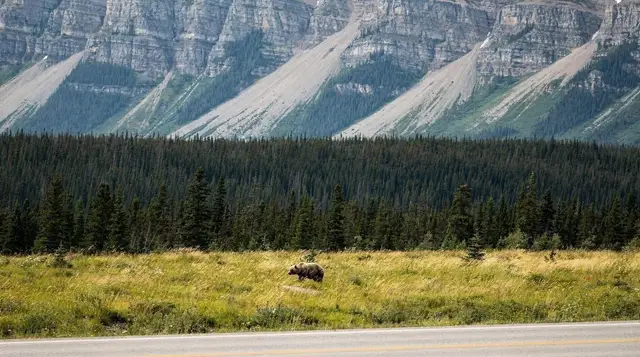
Most people crossing between Banff and Lake Louise default to the Trans-Canada Highway because it’s faster. The Bow Valley Parkway, Highway 1A, runs parallel to it along the valley floor and does the opposite job: it slows you down on purpose. Lower speeds, a narrower two-lane road, and a run of roadside meadows and forest edges make it the most reliable stretch of pavement in the park for spotting elk and deer from the driver’s seat, with the occasional wolf or black bear crossing thrown in if the timing works out.
None of that is available year-round, and it’s the detail that catches out a fair number of spring visitors: the eastern half of this road closes completely to vehicles for roughly four months every year, specifically so the wildlife that makes the drive worth doing gets a stretch of undisturbed time to breed and raise young. This page covers how that closure works, what actually opens back up once it lifts, and how to drive the route properly the rest of the year.
It doesn’t cover general wildlife-viewing hours across the whole park — see the wildlife viewing map and times guide for that — and it doesn’t cover Johnston Canyon as a hike, even though its trailhead sits directly on this road; that’s handled on its own page.
Where the parkway fits between Banff and Lake Louise
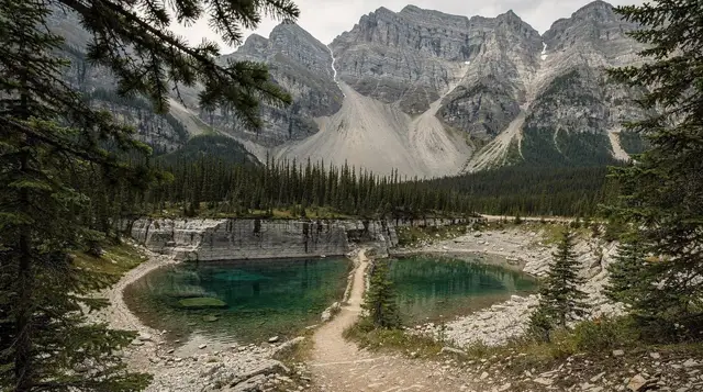
The Bow Valley Parkway runs along the north side of the Bow River, roughly tracking the same corridor as the Trans-Canada Highway but sitting lower in the valley and further from the interstate-style traffic. It connects Banff at its eastern end to Lake Louise at its western end, where it rejoins Highway 1 near the point that feeds into the Icefields Parkway heading north.
Because it parallels the Trans-Canada rather than replacing it, you’re never actually stuck with only this option. Drivers pressed for time can take the highway in one direction and loop back on the parkway in the other, or simply use the Trans-Canada both ways and treat the parkway as a deliberate detour reserved for days when watching for wildlife is the point of the drive, not an incidental bonus.
The spring closure, and why it exists
The detail that changes everything about planning a visit here is the seasonal closure. The eastern section of the Bow Valley Parkway — the stretch nearer Banff — is closed to all motor vehicles from March 1 to June 25 each year. That’s roughly four months, spanning early spring through late June, and it isn’t a minor restriction or a partial slowdown: through that window, the closed section simply isn’t drivable, full stop.
The reasoning is straightforward once you know what the road passes through. Late winter into early summer is when elk calve, when deer give birth, and when a range of other wildlife in the valley are at their most vulnerable to disturbance — easily displaced from good habitat, more likely to bolt into traffic, and less able to recover from repeated stress than they are later in the season. Parks Canada closes the section to vehicle traffic for exactly that window so the animals that make this corridor worth driving get a few undisturbed months to raise the next generation. It’s a wildlife-management decision first, and a visitor-experience one only as a side effect.
Two things are worth being precise about before you plan around these dates. First, the closure applies specifically to the eastern section, closer to Banff; the western section, nearer Lake Louise, generally stays open to vehicles right through the closure window, so a spring trip isn’t automatically shut out of this road entirely. Second — and this is the detail that trips people up — March 1 to June 25 is the standard, published window, not an immovable fact carved into the landscape.
Parks Canada sets and occasionally adjusts these dates based on conditions on the ground in a given year, so treat the dates here as the usual pattern and confirm the current closure notice on the official Parks Canada website, or at a visitor centre in Banff, before you build a spring itinerary around driving this road. A Parks Canada day pass is required either way, closure or not, simply for being in the park.
| Section | Typical status | Notes |
|---|---|---|
| Eastern section (near Banff) | Closed to vehicles, roughly March 1–June 25 | Cyclists and pedestrians often still permitted; confirm current notice |
| Western section (near Lake Louise) | Generally open year-round | Not affected by the eastern closure |
| Full parkway | Open, both directions | Typically late June through late February |
During the closure, the restriction is specifically on motor vehicles. Cyclists and walkers can often still use the closed section under the same seasonal notice, which makes for a genuinely quiet stretch of road if you’re travelling on two wheels or on foot rather than four — though you’re sharing that quiet with the same wildlife the closure exists to protect, so the standard distances still apply.
What opens back up, and when
Once the closure lifts in late June, the full length of the Bow Valley Parkway reopens to vehicle traffic and stays that way through summer, fall, and winter, right up until the next closure begins the following March. That’s the bulk of the calendar year — roughly eight months of unrestricted access — so for most travellers visiting outside the specific March-to-June window, the closure is a piece of background trivia rather than something that actually affects their trip.
Summer and fall are when the parkway sees the most traffic, both from vehicles and from the wildlife it’s known for; elk in particular become considerably more visible — and more dangerous — during the September and October breeding season, covered in detail in the elk rut warning guide. Winter keeps the road open too, plowed like the rest of the park’s main routes, though shorter daylight hours and occasional icy patches change the driving conditions; see the winter driving in the Rockies guide before a winter run along this corridor.
What you’re actually likely to see
Elk and mule deer are the most dependable sightings on this road, and it’s not close. Both species graze the open meadows and forest edges that line much of the parkway, and dawn and dusk light — already better for photography — tends to coincide with when they’re most active and visible from the road. White-tailed deer and coyotes show up regularly as well, often crossing or working the ditch line without much concern for passing traffic.
Wolves and black bears are a different matter. Both use this valley corridor, and both cross the road often enough that a sighting isn’t rare exactly — but neither shows up on a schedule, and neither should be the reason you plan a specific drive. If a wolf or bear sighting is genuinely the goal rather than a bonus, a guided evening tour with a driver who knows the current activity in the valley meaningfully improves your odds over a solo pass at an unpredictable time of day; the general patterns of where and when different species tend to appear across the whole park are covered in the wildlife viewing map and times guide, which isn’t limited to this one road.
Whatever you see, the standard safety distances apply the same as anywhere else in the park: 100 metres from bears and wolves, 30 metres from elk, deer, and other wildlife. Full guidance on giving animals space, reading warning signs, and what to do if an encounter gets closer than planned is in the bear safety and etiquette guide.
Driving it properly
The Bow Valley Parkway is not the road to be on if you’re in a hurry, and it punishes drivers who treat it like a highway. Posted speed limits sit well below Trans-Canada Highway speeds for a reason: it’s a narrow two-lane road shared with cyclists, with wildlife that can appear at the roadside without warning, and with other drivers who brake suddenly the moment they spot something interesting ahead. Treat the posted limit as a ceiling you rarely need to reach, not a target.
Stopping etiquette matters here more than on most park roads. Pull off only at designated turnouts and viewpoints — stopping in the driving lane, even for a few seconds to photograph an elk at the roadside, creates a real hazard for the traffic behind you and adds unnecessary stress to the animal you stopped for. If a good sighting happens between turnouts, the safer call is almost always to keep moving and watch for the next legal pull-off rather than braking where you are.
A short list of habits worth building before you start the drive:
- Keep well under the posted limit through open meadow sections, where animals are most likely to be near the road edge.
- Use turnouts, not the traffic lane, for any stop — including a “just for a second” photo.
- Expect sudden braking from other vehicles ahead of you, and leave more following distance than you would on the Trans-Canada.
- Never approach or feed anything you see, regardless of how used to vehicles it looks.
- Keep windows and food secured; this is bear country along its full length, not just at named attractions.
Stops worth the slower pace
Because you’re already moving at a fraction of highway speed, it makes sense to build in a few stops rather than drive the parkway end to end without pausing. Johnston Canyon sits directly on this road and draws the heaviest foot traffic of any stop along it, though the canyon trail itself is covered separately in the Johnston Canyon and Ink Pots guide rather than here. Near the western end, Castle Mountain rises directly above the road, one of the more distinctive rock profiles in the valley and an easy point of reference for where you are on the drive.
The historic Silver City site, once a short-lived mining settlement, and Muleshoe day-use area both sit along the route as well, offering quieter pull-offs than the busier named attractions — useful options if the main turnouts are full or if you’d simply rather scan a meadow for elk without a crowd around you. None of these smaller stops require much time; the point of this road is the drive itself and the chance of what you see along it, not a string of major attractions demanding hours each.
How it compares to the Trans-Canada Highway
| Bow Valley Parkway (Hwy 1A) | Trans-Canada Highway (Hwy 1) | |
|---|---|---|
| Typical pace | Slow, wildlife-focused | Fast, direct |
| Wildlife visibility | High — elk, deer regularly roadside | Lower — higher speeds, fenced sections |
| Spring access | Eastern section closed March 1–June 25 | Open year-round |
| Best for | A deliberate scenic drive, photography, wildlife | Getting between Banff and Lake Louise quickly |
| Road character | Narrow two-lane, turnouts, cyclists present | Divided highway sections, higher limits |
Neither road is the wrong choice; they serve different trips. If you’re transiting between towns on a tight schedule, the Trans-Canada gets you there without the deliberate slowdown. If the drive itself is part of the point — and especially if wildlife-watching from the car is something you’re prioritizing on this trip — the parkway is the better use of the same stretch of valley, outside its closure window.
Guided options if you’d rather not drive it solo
Self-driving the parkway at a careful pace is the cheapest way to try your luck, but a guided wildlife tour adds two things a solo drive can’t: a driver who knows where activity has been recent, and someone else handling the road while you watch. An evening wildlife safari that times the drive around dusk activity takes advantage of exactly the light and timing when elk and deer are most visible along corridors like this one. For a broader look that pairs wildlife-watching with other Banff stops in the same outing, a combined Canmore and Banff wildlife tour covers more ground than a single road allows.
If your schedule only allows one dedicated wildlife outing, a three-hour evening wildlife viewing and sunset tour is built specifically around the low-light window when sightings peak. And for travellers who want to combine a wildlife drive with some cultural and historical context rather than scenery alone, a wildlife tour that also stops at the Cave and Basin heritage site pairs the two in a single afternoon or evening.
Winter along the parkway
Winter doesn’t close the Bow Valley Parkway — the seasonal closure runs the opposite direction, protecting the road in spring rather than in the cold months — but it does change how you should drive it. Shorter daylight hours push the best wildlife-viewing window earlier in the afternoon, snow narrows the usable shoulder for any roadside stop, and icy patches show up more often on the shaded sections under the tree line than they do on the open highway. The full detail on tire requirements, road conditions, and driving habits for this season is in the winter driving in the Rockies guide, and it applies here as much as anywhere else in the park.
Bow Valley Parkway wildlife route FAQ
Why is part of the Bow Valley Parkway closed every spring?
The eastern section closes to protect wildlife during the spring breeding and calving period, when animals such as elk and deer are more vulnerable to disturbance and more likely to be struck by vehicles if pushed onto the road. Parks Canada restricts the corridor so that section of habitat gets several undisturbed months each year.
What are the exact closure dates?
Parks Canada’s standard closure runs from March 1 to June 25, but treat that as the usual window rather than a fixed law of nature. The parkway is co-managed for wildlife, not tourism convenience, so dates have shifted by a few days in past years. Check the current notice on the Parks Canada website or at a visitor centre before you plan a spring visit around this drive.
Which part of the parkway is closed, and which stays open?
The closure applies to the eastern section of the Bow Valley Parkway, nearer Banff. The western section, closer to Lake Louise, generally remains open to vehicles year-round. During the closure window, cyclists and pedestrians can typically still use the closed section, subject to the same seasonal notice.
What wildlife will I actually see driving the parkway?
Elk and mule deer are the most reliable sightings, often browsing roadside meadows at dawn or dusk. White-tailed deer and coyotes turn up regularly too. Wolves and black bears cross the corridor but are far less predictable — a good sighting is a matter of timing and luck, not something to plan a trip around.
How fast can you drive the Bow Valley Parkway?
The posted limit runs well below Trans-Canada Highway speeds, and for good reason: this is a two-lane road shared with wildlife, cyclists, and drivers stopping suddenly for a roadside sighting. Treat the posted signs as the ceiling, not the target, and expect to average a slower pace than the number on the sign might suggest.
Is the Bow Valley Parkway a shortcut between Banff and Lake Louise?
Not really. The Trans-Canada Highway covers the same stretch faster, with higher speeds and no through-traffic wildlife closure. The parkway exists as the slow, scenic alternative — worth it if you have time to spare and want the chance of a wildlife sighting, not the route to pick if you’re in a hurry.
Can you stop wherever you see an animal?
Only at designated pull-offs and turnouts. Stopping in the traffic lane, even briefly, creates a hazard for the vehicles behind you and stresses the animal further. If a sighting happens between turnouts, the safer move is to keep going and watch for the next legal place to pull over.
Is Johnston Canyon accessed from this road?
Yes, Johnston Canyon’s trailhead sits directly on the Bow Valley Parkway, but this page covers the parkway as a driving and wildlife-viewing route rather than the canyon hike itself — see the dedicated Johnston Canyon guide for trail details.
Wildlife & nature tours on GetYourGuide
Verified deep-linked GetYourGuide tours. Book through these links and we earn a small commission at no cost to you.
GetYourGuide does not provide a product photo for this activity — the image shows the meeting point, photographed by us.