What Castle Mountain actually looks like from the road
Castle Mountain earns its name honestly. Where most peaks in this stretch of the Rockies rise as jagged, irregular masses, Castle Mountain presents a long horizontal wall of grey limestone and dolomite, cut into vertical bands that really do read as ramparts and turrets from a distance. It sits on the Bow Valley Parkway (Highway 1A), roughly halfway along the older, slower route that runs parallel to the Trans-Canada Highway between Banff and Lake Louise.
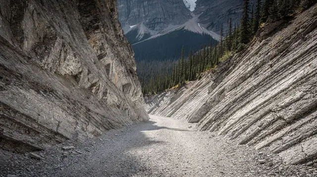
This is not a peak you climb to a summit for a view. It is a peak you look at. The mountain’s structure — flat-lying sedimentary layers stacked and eroded into cliff bands — is a textbook example of the kind of geology that built the whole Front Range of the Rockies, and it happens to be visible from a paved pull-off without any walking at all. That combination is rare enough in this park that it is worth the short detour, even for visitors who have no intention of lacing up boots.
The mountain also carries a second name that shows up on some older maps and signage: Mount Eisenhower, a name applied in 1946 and reversed by the Canadian government in 1979 after public objection. Locals and current maps use Castle Mountain. A smaller outlying summit near the main massif still carries the name Eisenhower Tower, which is the one piece of the old naming that survives officially today.
Getting there from Banff — and why it is not a walk
This is the point where a lot of visitors misjudge the trip. Castle Mountain is about 30 kilometres from Banff townsite, a 25 to 30 minute drive by the Bow Valley Parkway or the faster Trans-Canada Highway. It is not a bike ride from downtown and it is absolutely not walkable — treating it as a last-minute add-on to an afternoon in Banff, on foot, is the single most common mistake tied to this stop. If you are staying in Banff without a car, seeing Castle Mountain means either renting one, joining a tour that runs the parkway, or catching a ride with someone headed toward Lake Louise.
| From | Distance | Drive time |
|---|---|---|
| Banff townsite | ~30 km | 25–30 min |
| Lake Louise village | ~28 km | 20–25 min |
| Canmore | ~50 km | 40–45 min |
| Johnston Canyon | ~13 km | 10–15 min |
The Bow Valley Parkway itself has a seasonal wrinkle worth knowing before you go: the eastern section, between the Fireside picnic area and Johnston Canyon, is closed to vehicles from March 1 to June 25 to protect wildlife during a sensitive period. Castle Mountain sits west of that closure zone, so the viewpoint and trailhead stay reachable by car through the closure, but plan your route on the parkway with that section in mind — you may need to approach from the Lake Louise end or use the Trans-Canada instead during those months. See our wildlife route guide for the full closure map.
A Parks Canada pass is required to be on this road at all, even just passing through — roughly 11 CAD per adult per day or about 22 CAD per vehicle, with an annual Discovery Pass around 75 CAD per adult. Check the current rate before you go.
The viewpoint: five minutes, and worth it
The main roadside pull-off sits along the Bow Valley Parkway with a clear, unobstructed view of the mountain’s south face. There is a small parking area, interpretive signage explaining the geology and the naming history, and enough room to get a genuinely good photograph without a telephoto lens. This is the stop most people should plan for: five to fifteen minutes, no hiking boots required, works in any season the parkway is open and plowed.
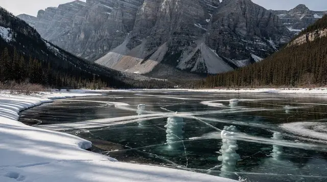
Morning light tends to be flatter here; late afternoon and early evening pick out the cliff bands with more contrast. Winter visits show the mountain dusted in snow against a pale sky, and the pull-off is usually still accessible, though check road conditions after a storm.
There is no fee for the viewpoint itself beyond the Parks Canada pass already required for the road, and no facilities beyond the pull-off — Johnston Canyon, a short drive back toward Banff, has the nearest washrooms and concessions.
Castle Junction: the crossroads, not a village
A short distance from the viewpoint, the parkway meets the road junction known as Castle Junction, a functional highway interchange rather than a town. There is a small commercial stop here — fuel, a limited convenience selection, and seasonal food service — but do not expect a village centre or overnight infrastructure. It exists mostly as a waypoint for drivers and a turn-off toward Kootenay National Park via Highway 93 South, which is a different trip entirely from the Castle Mountain viewpoint and not something to combine casually into the same afternoon.
The trail: Rockbound Lake, for hikers who want a workout
For visitors who want more than a photo stop, the trailhead near Castle Junction leads to Rockbound Lake, a genuinely demanding hike that gets a fraction of the traffic of the big-name trails closer to Banff and Lake Louise.
The numbers matter here because this trail punishes anyone who underestimates it:
| Metric | Detail |
|---|---|
| Round-trip distance | 16.8 km |
| Elevation gain | About 920 m |
| Typical time | 6–8 hours |
| Difficulty | Challenging |
The trail climbs through forest for several kilometres with limited views before breaking out above the treeline, passing an old fire lookout site, and eventually reaching Rockbound Lake itself — a small alpine lake cupped in a rocky basin behind the mountain, well away from any road. The payoff is solitude: this is one of the quieter big hikes in the Banff area precisely because the distance and elevation gain scare off casual visitors.
Snow can linger in the upper basin well into July in a heavy year, and afternoon thunderstorms are common in summer on the exposed upper sections. Start early, carry more water than feels necessary, and check current trail reports before committing — this is not a hike to begin after lunch. For comparison against other options in the park, see our guide to day hikes sorted by difficulty.
There is no shorter, easier version of this trail that reaches the lake. A partial hike to the old fire lookout site, roughly 7 km round trip with about 520 m of elevation gain, gives a taste of the terrain and a real view back down the valley without committing to the full day, and is a reasonable option for hikers who want the forest and the first views without the whole climb.
Photography notes
Castle Mountain photographs best as a wide shot that takes in the full horizontal sweep of the cliff bands — a standard zoom or even a phone camera handles it well from the main pull-off, since the mountain sits close enough to the road that a long lens is not necessary. Winter shots with fresh snow on the upper bands tend to be the most requested images of this mountain, and they are achievable without any hiking at all, which is unusual for the Rockies’ more photogenic peaks.
Where Castle Mountain fits into a Banff–Lake Louise day
Most visitors encounter Castle Mountain as one stop among several on a drive along the Bow Valley Parkway, rather than as a planned destination on its own. A typical sequence heading from Banff toward Lake Louise might run Johnston Canyon, then Castle Mountain, then on to Lake Louise itself or continuing further to Moraine Lake — keeping in mind that Moraine Lake’s access road has been closed to private vehicles year-round since 2023, so that leg needs its own shuttle or tour booking regardless of how the rest of the day is arranged.
For visitors planning the whole corridor as a single day, our Lake Louise and Moraine Lake day trip guide lays out a realistic schedule.
A guided tour along this corridor removes the guesswork around parking, timing the parkway’s seasonal closures, and coordinating a Moraine Lake shuttle in the same day. The Lake Louise, Marble Canyon and Emerald Lake day tour runs a version of this westbound route with stops most self-drivers would otherwise have to plan separately, and it is a reasonable option for visitors without a car who still want to see this stretch of highway properly.
Drivers continuing past Lake Louise toward the Icefields Parkway can combine Castle Mountain into a longer loop; the Icefields Parkway tour from Calgary covers the full corridor north, for anyone who wants the geology of Castle Mountain as a warm-up to the glaciers further along Highway 93.
Where Castle Mountain does not belong
It is worth being direct about what this stop is not. Castle Mountain is not a substitute for Mount Rundle or Tunnel Mountain, the peaks that frame Banff townsite itself — those sit right next to Banff and have their own separate trails and viewpoints, much closer to downtown. Castle Mountain is a different, more distant landmark that belongs to the drive toward Lake Louise, not to a Banff townsite itinerary. If your plan is a short walk from your hotel, this is the wrong mountain; if your plan is a scenic stop on a drive you are already making, it is a good one.
It is also not a place to build a full day around unless you are hiking to Rockbound Lake. Visitors who arrive expecting a village, a visitor centre, or services beyond the Castle Junction fuel stop will be disappointed. Treat it as what it is: a five-minute photo stop with an optional, serious hike attached.
Nearby stops worth combining
Because Castle Mountain sits roughly midway between Banff and Lake Louise, it pairs naturally with other stops along the same stretch of road rather than standing alone:
- Johnston Canyon — waterfalls and a boardwalk trail, about 13 km closer to Banff; the full-day Johnston Canyon sightseeing tour covers this stop alongside several others on the parkway.
- Vermilion Lakes — a quieter reflection spot near Banff itself, if you are starting from town.
- Lake Louise — the natural continuation westbound, about 28 km further along.
- Canmore — a base option south of Banff, if you are approaching the parkway from that direction.
For a broader sense of how to sequence a day that includes this corridor, our Banff versus Lake Louise base guide and our guided tour versus rental car comparison both address the logistics question that comes up most: whether to drive yourself or book a tour that handles the parkway, the passes, and the timing.
Hikers weighing Rockbound Lake against the park’s other demanding trails, including the busier alpine routes near Lake Louise during larch season, should check our bear safety guide before setting out — this is bear country with real backcountry exposure on the upper sections.
Castle Mountain: frequently asked questions
How far is Castle Mountain from Banff?
About 30 kilometres by road, a 25 to 30 minute drive along the Bow Valley Parkway or the Trans-Canada Highway. It is not walkable or bikeable from Banff townsite as a casual outing.
Do I need a Parks Canada pass to see Castle Mountain?
Yes. The Bow Valley Parkway runs through Banff National Park, so a Parks Canada day pass or Discovery Pass is required even for a short stop at the viewpoint, in addition to any other park access you have already paid for that day.
Is the Castle Mountain viewpoint accessible without hiking?
Yes. The main viewpoint is a roadside pull-off with parking and interpretive signage. No trail walking is required to see the mountain’s cliff face clearly.
How hard is the hike to Rockbound Lake?
It is a challenging 16.8-kilometre round trip with about 920 metres of elevation gain, typically taking 6 to 8 hours. It is significantly harder than most of the popular short trails near Banff and Lake Louise.
Is there a shorter hike option near Castle Mountain?
A partial hike to the old fire lookout site, about 7 km round trip with roughly 520 m of elevation gain, offers forest walking and valley views without the full commitment to Rockbound Lake.
Is the Bow Valley Parkway near Castle Mountain ever closed?
The eastern section of the parkway, between Fireside and Johnston Canyon, closes to vehicles from March 1 to June 25 for wildlife protection. Castle Mountain sits west of that closure, but check current routing before you drive out, especially in spring.
Can I combine Castle Mountain with Lake Louise or Moraine Lake in one day?
Yes, and this is the most common way visitors see it — as a stop on the drive toward Lake Louise. Remember that Moraine Lake requires a shuttle or tour booking, since its access road has been closed to private vehicles year-round since 2023.
Is there anywhere to eat or stay at Castle Mountain?
Castle Junction has limited seasonal fuel and food service, but no overnight accommodation or village centre. Plan meals and lodging around Banff, Lake Louise, or Canmore instead.