Crowfoot Glacier viewpoint on the Icefields Parkway
Where is the Crowfoot Glacier viewpoint and do you need to hike to it?
The Crowfoot Glacier viewpoint is a signed roadside pull-off on the Icefields Parkway (Highway 93 North), between Lake Louise and Bow Lake. You park, walk a few steps to the railing, and look up at the glacier — no trail and no elevation gain involved.
The stop most drivers almost drive past
Coming north out of Lake Louise on the Icefields Parkway, the first proper glacier viewpoint arrives before you’ve even reached Bow Lake. There’s no hike, no admission gate, and nothing to book. You pull into a signed roadside lay-by, walk a few metres to a railing, and look up at a hanging glacier draped across the shoulder of the mountain on the far side of the valley. That’s the entire visit, and it’s exactly why it’s worth doing properly rather than glancing at it through the windshield at 90 km/h.
This page covers that one pull-off: what’s there, why the glacier carries the name it does, and what changed about its shape since someone first named it. It doesn’t cover Bow Lake or Peyto Lake, both of which get their own stops a little further north — see the Icefields Parkway stops in order guide for how all of it strings together into a single drive, or the complete Icefields Parkway guide if you’re still deciding whether to drive the whole 232-kilometre route to Jasper or turn back after this stretch.
Finding the pull-off
Heading north from Lake Louise on Highway 93, the sequence of named stops runs Herbert Lake, then Crowfoot Glacier, then Bow Lake, then Bow Summit and Peyto Lake. The Crowfoot Glacier viewpoint is the second of those, a paved pull-off on the east shoulder of the highway with a Parks Canada interpretive sign at the railing. It sits below the treeline, so the glacier is framed by forest and rock rather than isolated against open sky, which is part of what makes it easy to miss if you’re not watching for the pull-off itself.
There’s no formal parking lot, washroom, or food service here — just shoulder parking for a handful of vehicles. If it’s full, the safest option is to continue on to the day-use area at Bow Lake and treat that as the next planned stop rather than trying to squeeze into a gap on the highway shoulder.
| Stop (north from Lake Louise) | What’s there | Effort |
|---|---|---|
| Herbert Lake | Small roadside lake, mountain reflection | Look-out from car park |
| Crowfoot Glacier | Hanging glacier across the valley | Roadside railing, no walk |
| Bow Lake | Glacier-fed lake, Num-Ti-Jah area | Short walk to shoreline |
| Bow Summit / Peyto Lake | High point of the parkway, overlook | Short uphill walk to platform |
A Parks Canada day pass covers this stop the same as every other point along the parkway — it’s required for simply passing through Banff and Jasper national parks, not only for parking at a specific attraction.
Why “Crowfoot”: a name that outlived the shape
The glacier’s name comes from its outline as seen from the road: early visitors described three separate ice tongues fanning out from the upper icefield, splayed the way a crow’s toes spread when it lands, with a central “leg” of ice and two side toes reaching down the mountainside. Someone travelling this route in the early days of parkway tourism looked up, saw the three-toed shape, and the name Crowfoot Glacier stuck.
That’s the detail worth getting right before you look up: the shape that gave the glacier its name is not fully there anymore. Glacial retreat has removed the lowest of the three toes entirely — it thinned and disconnected from the main ice mass over the course of the twentieth century, and what once reached furthest down the slope is now gone, replaced by bare rock and scree. What you actually see today from the pull-off is two remaining ice tongues, not three. If you’re expecting the full three-toed crow’s foot the name describes, you won’t find it; the name is a record of how the glacier used to look, not a description of what’s currently on the mountain.
This is worth flagging clearly because it’s an easy detail to get backwards: the missing lower toe did not just become harder to see, or move to a different angle — it melted away and is not part of the current view from any angle at this pull-off. Two lobes are what’s left, and two lobes are what the interpretive sign at the railing shows too.
What the missing toe tells you about the glacier
Crowfoot Glacier is a small, useful case study in how mountain glaciers respond to a warming climate, and it’s a more approachable one than the Athabasca Glacier further north because you can take in the whole thing from one fixed viewpoint without walking anywhere. The glacier sits below the ridgeline of Crowfoot Mountain and is fed from the same general icefield system that feeds several other named glaciers visible from the parkway. Like most glaciers in the Canadian Rockies, it has been losing mass and retreating for decades, and the disappearance of its lowest ice tongue is a visible, dated example of that process rather than an abstract statistic.
If the mechanics of glacial retreat interest you beyond this one glacier, the glacier retreat explained guide covers how it’s measured and why the Columbia Icefield further north, with the Athabasca Glacier and its Ice Explorer tours, shows the same pattern at a larger scale.
What you’re actually looking at from the railing
From the pull-off, the glacier hangs on the mountainside across the valley, distant enough that you’re not craning your neck but close enough to make out real detail: two separated tongues of blue-white ice, visible crevasse lines where the ice has cracked and shifted, and a clear boundary between the ice and the bare rock and scree below it where the retreated portion used to sit. Binoculars or a zoom lens sharpen the detail, but you don’t need either to appreciate the shape and scale of it.
The valley floor below is forested, and the pull-off itself sits at a lower, more sheltered elevation than the exposed viewpoint at Bow Summit further up the road, so don’t expect the same wide, open panorama you get there. This is a single, framed view of one glacier, not a sweeping vista — which is exactly what makes it quick to visit and easy to combine with other stops on the same drive.
Morning light tends to work best here: the sun sits behind you rather than behind the glacier for a good stretch of the morning, which keeps the ice from washing out into a flat white glare against the sky. By mid-afternoon on a clear day the glacier can look duller and harder to photograph well, though it’s still perfectly visible for a quick look. Either way, this isn’t a stop worth timing your whole day around — it’s one frame in a longer drive, not the reason to leave the hotel at a particular hour.
How long to spend here
Realistically, this is a five-to-fifteen-minute stop. You pull off, read the interpretive panel, look at the glacier, take a photo, and get back on the road. There’s nothing to extend the visit — no trail leading further in, no facilities, no separate viewing platform beyond the roadside railing. That’s not a shortcoming; it’s the point. Treat it as a punctuation mark in a longer drive rather than a destination in its own right, and budget your Icefields Parkway day accordingly, the way the one day versus two days guide lays out for the full run to Jasper.
Because there’s no fuel, food, or washroom at the pull-off itself, and services are genuinely sparse for long stretches further north on the parkway, it’s worth topping up on fuel and using a washroom in Lake Louise before you set out — see the gas and cell coverage guide for exactly where the gaps are.
Fitting it into your day
Most people reach the Crowfoot Glacier pull-off as the first proper glacier stop on a longer drive up the parkway, whether that’s a half-day out-and-back from Lake Louise or the full run to Jasper. It works well as a brief warm-up stop before the more involved visits at Bow Lake and Bow Summit / Peyto Lake, and it doesn’t compete for time with either since it takes so little of it.
If you’re driving the parkway as part of a multi-day loop rather than a single long day, the Icefields Parkway road trip itinerary places this stop in context alongside the Columbia Icefield and the towns at either end. And if you’re deciding how far north to go at all, this pull-off is one of the easiest wins on the whole route — it costs almost no extra driving time relative to continuing straight through.
Season, weather, and road conditions
The Icefields Parkway is plowed and kept open through most of the winter, with occasional closures during storms or avalanche control work, so the pull-off is generally reachable whenever the highway itself is open. In winter, expect a narrower shoulder, snowbanks around the parking area, and a shorter, more careful stop rather than a leisurely one. In summer, the pull-off can fill during the July–August peak, particularly around midday when tour coaches and self-drive traffic overlap.
Weather changes quickly at this elevation regardless of season — cloud can roll in and obscure the glacier within minutes, so if the sky is clear when you’re approaching, it’s worth stopping rather than assuming you’ll get as good a view on the way back. Cell coverage along this stretch of the parkway is unreliable, so don’t count on looking up conditions once you’re already on the road north of Lake Louise.
Wildlife and safety at a roadside stop
This is still bear and wildlife country, even at a quick highway pull-off. Keep the standard distances — 100 metres from bears and wolves, 30 metres from elk, sheep, and other wildlife — and never feed anything that wanders near the shoulder. Because it’s a working highway shoulder rather than a dedicated parking lot, watch for traffic when pulling in and out, keep an eye on kids and pets near the road edge, and don’t leave food unattended in an open vehicle while you’re at the railing.
Tours that include this stop
Self-driving is the simplest way to see the Crowfoot Glacier pull-off on your own schedule, but it’s also a standard stop on most guided Icefields Parkway day tours, since it costs the operator almost no extra time to include. If you’d rather not drive the parkway yourself, or you want the context a guide provides at the railing, a few options build it in alongside the bigger stops further north:
A full day tour along the route, covering Bow Lake, Peyto Lake, and this glacier viewpoint in one guided outing, works well if you want the whole corridor narrated rather than self-guided. For travellers based further out, a day trip from Calgary, Banff, or Canmore that strings together seven lakes along with this glacier stop covers a lot of ground without you having to drive it.
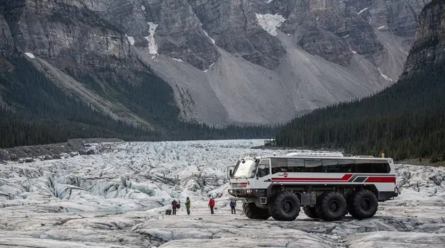
And if the ultimate goal is standing on glacier ice rather than just viewing one from the road, a tour that pairs this stretch of the parkway with the Ice Explorer experience on the Columbia Icefield further north extends the day into that bigger attraction.
Crowfoot Glacier viewpoint FAQ
Where exactly is the Crowfoot Glacier viewpoint?
It’s a paved pull-off on the east side of the Icefields Parkway (Highway 93 North), north of Lake Louise and south of Bow Lake — the second named stop heading north after Herbert Lake. A Parks Canada sign at the railing identifies the glacier and its shape.
Why is the glacier called Crowfoot if it doesn’t look like a foot anymore?
Early visitors named it for three ice tongues splayed like a crow’s toes. Glacial retreat has since removed the lowest tongue entirely, so today’s view shows two hanging lobes rather than three. The name stuck even after the shape it described partly disappeared.
Is there a fee to stop at the pull-off?
Stopping is free, but you’re inside Banff National Park, so a valid Parks Canada day pass or Discovery Pass needs to be in the vehicle, the same as anywhere else along the parkway.
How long should I plan for this stop?
Most people are back in the car within 5 to 15 minutes. There’s a viewing railing and an interpretive panel, but no trail, washroom, or food service to extend the visit.
Can you hike up to Crowfoot Glacier itself?
No maintained public trail climbs to the glacier from this pull-off. What you see from the railing is the full extent of the visitor experience here; reaching the ice is technical mountaineering terrain, not a day-hike option.
Is the Crowfoot Glacier pull-off open in winter?
The Icefields Parkway generally stays open through winter with plowing and occasional storm closures, and the pull-off is accessible when the highway is. The shoulder is narrower under snow, so plan a shorter, more careful stop and check current road conditions before you go.
How does this stop compare to Bow Lake and Peyto Lake?
It’s quicker and requires less commitment than either. Bow Lake and Peyto Lake both involve parking further from the highway and walking to a lake or viewing platform; the Crowfoot Glacier pull-off is a look-up-and-go stop directly off the road.
Do I need binoculars to see the glacier well?
You don’t need them, but they help. The glacier hangs on the mountain across the valley, close enough to make out the two separate ice tongues and crevasse patterns with the naked eye, and clearer still with binoculars or a zoom lens.
Columbia Icefield & glacier tours on GetYourGuide
Verified deep-linked GetYourGuide tours. Book through these links and we earn a small commission at no cost to you.
GetYourGuide does not provide a product photo for this activity — the image shows the meeting point, photographed by us.