Peyto Lake viewpoint: what you actually see from Bow Summit
Can you walk down to Peyto Lake, or is it only a viewpoint?
Peyto Lake is seen from the Bow Summit lookout on the Icefields Parkway, at about 2,088 metres, roughly a 10 to 15 minute walk from the parking lot. There's no maintained trail down to the shoreline for the general public, and a Parks Canada pass is required on this stretch of highway even if you're only passing through.
A lookout, not a lakeshore
Peyto Lake is one of the most photographed views on the Icefields Parkway, and also one of the most misunderstood. The postcard shot — a wedge of impossibly blue-green water pointing toward distant peaks — is taken from a viewing platform well above the water, not from a beach or a dock beside it. If you’re picturing something you can wade into or paddle across, recalibrate before you go: this is a look-but-don’t-touch stop, and that’s true for nearly every visitor, not just the ones in a hurry.
The lake sits below Bow Summit, at 2,088 metres the highest point on the Icefields Parkway (Highway 93 North) and the boundary between the Bow River and Mistaya River watersheds. The parking area for Peyto Lake is right at the summit, and the platform looks down into a glacially carved valley roughly 240 metres below. That elevation difference is the whole story here: you get an aerial-style panorama in exchange for giving up shoreline access.
Getting to the viewpoint
The Peyto Lake parking lot is on the west side of Highway 93, about 40 kilometres north of Lake Louise and roughly 17 kilometres past Bow Lake and Crowfoot Glacier. It’s a well-marked stop with washrooms, and it fills up in summer.
From the lot, a paved, mostly flat path climbs gently for about 400 to 500 metres to the main viewing platform — call it 10 to 15 minutes each way for most people, less if you don’t stop for photos, which you will. This lower platform is wheelchair-accessible in dry conditions, though the grade means it takes some effort in a manual chair.
A second path continues past the main platform up a steeper, unpaved trail to a higher lookout with a wider view of the lake’s full outline. That climb adds roughly 15 to 20 minutes and about 100 metres of additional elevation gain, on a surface that turns slick when wet. It’s worth the extra time if you want the classic “wolf’s head” composition; skip it if you’re short on time or mobility isn’t ideal, since the lower platform already gives a clear view of the lake.
| Stop | Distance from lot | Elevation gain | Surface |
|---|---|---|---|
| Main viewpoint | ~450 m one-way | Gentle | Paved |
| Upper viewpoint | ~700 m one-way (total) | ~100 m | Gravel, steeper |
There is no route down to the water from either platform. The slope between the lookout and the lake is steep talus and unstable ground, closed to casual foot traffic, and not part of any maintained hiking trail. People occasionally scramble partway down anyway; it isn’t sanctioned, and it isn’t necessary for a good photo.
The parks pass, even for a quick stop
Bow Summit is inside Banff National Park, and the entire length of the Icefields Parkway between Lake Louise and the Jasper boundary runs through Banff and then Jasper National Park. That means a valid Parks Canada pass is required to stop here, in the same way it’s required anywhere else in the park — see our Parks Canada pass guide for current rates and how the daily and annual options compare. This catches people off guard on day trips from Calgary who assume a short pullout for photos doesn’t count; it does. Pass checks happen at the park gates on Highway 1 and at the Saskatchewan River Crossing area, and a highway patrol or warden can also ask to see it at any pullout.
If you’re combining this stop with Yoho or Kootenay on the same trip, note that a Banff/Jasper day pass covers Yoho and Kootenay too, since all four parks share one Parks Canada fee structure — it does not extend to the Kananaskis Conservation Pass, which is a separate provincial system with no relationship to your national park pass.
When the colour actually shows up
The turquoise-to-teal colour associated with Peyto Lake, like the other glacial lakes along this route, comes from finely ground rock — glacial flour — suspended in meltwater, which scatters light at the blue-green end of the spectrum. It isn’t present all year, and it isn’t present as soon as the snow clears from the road. For the full mechanism, see why the lakes turn turquoise.
Peyto Lake typically holds ice into late spring and starts opening up through May into early June, depending on the year. The strongest colour usually builds through late June and peaks in July and August, when glacial melt is at its highest volume. By late September the meltwater slows and the colour can turn a duller green. Our lake thaw timing guide has the season-by-season detail if you’re planning specifically around the water’s appearance rather than around crowds.
Practically: if your trip falls in May, expect a lake that’s partially frozen or a murky grey-green, not the bright postcard colour. That’s not a defect in the lake — it’s just outside the window when the colour is at its best.
The wolf’s head shape
Locals and guides often point out that Peyto Lake, seen from above, resembles a wolf’s head in profile, with the narrower northern arm forming the snout. It’s a genuine pattern in the shoreline, carved by the retreating glacier and the surrounding moraine, and it does show up in aerial photography and in wide shots from the upper viewpoint.
From the ground-level platform, with a phone camera and a crowd of other visitors around you, it reads as a general elongated shape rather than the crisp silhouette used in tourism photography — worth knowing so the shape doesn’t feel like a letdown when you’re standing there. For tips on framing this specific view well without a drone, see photographing lakes: phone vs. camera.
Crowds and timing
Peyto Lake is a mandatory stop for nearly every Icefields Parkway itinerary, tour bus route, and self-drive plan, which means the lot and platform get busy in the same windows as the rest of the parkway. Late June through early September, expect a full parking lot and a crowded platform between roughly 10 a.m. and 4 p.m., with tour buses arriving in waves. Early morning (before 9 a.m.) or later afternoon (after 5:30 p.m., with plenty of daylight left in summer) are noticeably quieter. Our lake crowds and quiet times guide covers this pattern across all the parkway’s lake stops, not just this one.
If you’re driving the full route from Lake Louise to Jasper in one day, budget the walk and photo stop at 30 to 45 minutes including parking delays, and see our guide on one day vs. two days on the Icefields Parkway for how that fits against the rest of the drive.
What else is at Bow Summit, and what isn’t
There’s no food service, no gas, and only limited cell coverage at Bow Summit — plan around that rather than expecting to find it, and see gas and cell coverage on the Icefields Parkway for the nearest reliable services in both directions. Washrooms are on site.
This guide covers Peyto Lake itself; it doesn’t cover Bow Lake, which sits lower on the same highway with its own shoreline access and a short walk to Bow Glacier Falls (see the Bow Lake and Crowfoot Glacier guide), and it doesn’t try to duplicate our roundup of the parkway’s other named viewpoints, which has its own dedicated guide. If you’re building a full-day plan, the stops-in-order guide sequences all of them, Peyto Lake included, so you’re not backtracking on a road that has limited passing room.
Booking a tour that includes this stop
If you’d rather not manage the driving, parking, and timing yourself, several day tours from Banff, Lake Louise, or Calgary build in a stop at the Peyto Lake viewpoint alongside other parkway highlights. A guide who knows the platform’s busy windows can also help you time the walk to avoid the worst of the midday crush.
For a full day that pairs this lookout with the ice-walking stop further north, the Columbia Icefield day tour with stops at Bow Lake and the Peyto Lake viewpoint covers the parkway’s two most-asked-about lake stops in one outing. If your priority is the lakes themselves rather than the icefield, the guided day trip taking in Lake Louise, Emerald Lake, and the Peyto Lake lookout is a more lake-focused alternative that skips the glacier walk.
And for travellers based in Calgary without their own car, the day tour departing Calgary for the Columbia Icefield with stops at Bow Lake and Peyto Lake handles the return drive as well, which matters on a road with no passing lanes and long stretches without services.
Practical notes before you go
- Bring layers. At 2,088 metres, Bow Summit runs noticeably colder and windier than Banff or Lake Louise, even in July. A t-shirt-and-shorts day in town can mean a windbreaker moment at the platform.
- Fuel up before you leave Lake Louise. There’s no gas station at Bow Summit or for a long stretch beyond it in either direction.
- Don’t expect cell service. Download maps or directions before you leave, since coverage along this section is unreliable at best.
- Watch the road, not just the view. Highway 93 North has no shoulder in places and wildlife crossings are common; slow down before pulling into the lot rather than braking hard at the entrance.
- Combine it deliberately. Because this is a short stop, it pairs naturally with a longer Icefields Parkway itinerary rather than standing alone as a destination.
Frequently asked questions about the Peyto Lake viewpoint
Can you get down to the water at Peyto Lake?
Not on a maintained trail. The lookout at Bow Summit sits roughly 240 metres above the lake, and the slope below it is steep, unstable in places, and not an official route. The overwhelming majority of visitors see Peyto Lake only from above, and that’s the point of this stop.
How far is the walk to the Peyto Lake viewpoint?
From the Bow Summit parking area it’s about 400 to 500 metres each way on a paved, uphill path, roughly 10 to 15 minutes at an easy pace. A second, higher viewpoint adds another 15 to 20 minutes of climbing on a gravel trail.
Do you need a Parks Canada pass to see Peyto Lake?
Yes. Bow Summit is inside Banff National Park on the Icefields Parkway, and a Parks Canada day pass or Discovery Pass is required for anyone stopping along this road, even for a short lookout visit or a same-day drive through to Jasper.
When does Peyto Lake turn turquoise?
Typically from mid to late June through September, once spring meltwater carries enough glacial rock flour into the lake. Photos showing bright turquoise water in April or May are from a previous season; the lake is usually still frozen or milky grey-green at that point.
Why does Peyto Lake look like a wolf’s head?
The outline is a coincidence of glacial scouring and the surrounding moraine, best seen from the elevated lookout looking north-west. The shape reads most clearly in aerial and drone photography; from the ground viewpoint it’s recognizable but less dramatic than promotional photos suggest.
How does Peyto Lake compare to Bow Lake, just down the road?
They’re different stops on the same stretch of the Icefields Parkway. Bow Lake sits at road level with lakeside access and a short walk to Bow Glacier Falls, while Peyto Lake is viewed from well above the shoreline. See our dedicated guide to Bow Lake and Crowfoot Glacier for that stop.
Is the Peyto Lake parking lot busy?
Yes, from late June through early September, especially between 10 a.m. and 4 p.m. The lot is modest in size for the volume of Icefields Parkway traffic, and overflow parking on the highway shoulder is common but not ideal for a narrow, high-speed road.
Gondolas & mountain viewpoints on GetYourGuide
Verified deep-linked GetYourGuide tours. Book through these links and we earn a small commission at no cost to you.
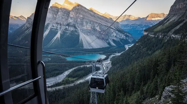
GetYourGuide does not provide a product photo for this activity — the image shows the meeting point, photographed by us.