A gravel link between Canmore and Kananaskis
South of Canmore, the pavement runs out. The Three Sisters Parkway, the road that carries traffic past Canmore’s condo developments and golf courses, quietly turns into the Smith-Dorrien Trail — sometimes signed and sold as the Smith-Dorrien/Spray Lake Road — and from there it’s gravel for most of the distance into Kananaskis Country. This isn’t a detour built for tour buses. It’s a working provincial road that happens to run along one of the more scenic reservoirs in the Alberta Rockies, and it’s used by locals, cyclists, anglers, and a steady trickle of visitors who want to see mountains without sitting in the Trans-Canada Highway traffic that backs up outside Canmore on a summer Saturday.
It is not a substitute for the paved highway system, and it shouldn’t be treated as one. Anyone expecting a shortcut, or expecting the same surface and reliability as Highway 1, will be disappointed and possibly stuck behind a grader. What it does offer is a genuinely different way to see this corner of the Rockies, at a slower pace, with the Spray Lakes Reservoir as the throughline for most of the drive.
Where the road starts and where it goes
The trail begins at the southern edge of Canmore, where residential streets give way to a gravel surface within a few kilometres. From there it climbs gently and runs south along the western shore of the Spray Lakes Reservoir, a long, narrow body of water held back by a dam built for hydroelectric power decades ago.
The road hugs the shoreline for a good stretch, with the peaks of the Goat Range rising on one side and the Kananaskis Range on the other, before it eventually reaches a junction with Kananaskis Lakes Trail — signed as Highway 742 — near Peter Lougheed Provincial Park. From that junction, drivers can continue on to the Kananaskis Lakes day-use areas or loop back to pavement and Highway 40, the main paved route into Kananaskis from the Trans-Canada.
Treated end to end, the Smith-Dorrien/Spray Lakes Trail functions as a back-road alternative to driving up Highway 40 from the Trans-Canada Highway junction east of Canmore. It’s longer in driving time and rougher underfoot, but it stays closer to the mountains the whole way and avoids the highway traffic that builds up on Highway 40 on busy weekends. Some visitors drive it one way and return via the paved highway loop, turning the whole thing into a half-day or full-day circuit rather than a there-and-back.
Road surface, conditions, and what kind of vehicle you need
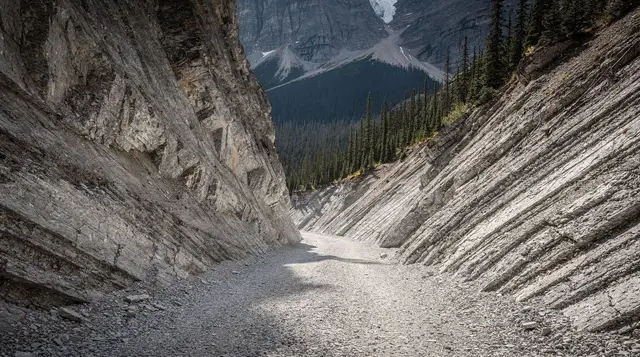
Be clear-eyed about the surface before setting out: this is a gravel road for the great majority of its length, not a paved scenic parkway. A short stretch close to Canmore is sealed, but once the route settles in alongside the reservoir, it’s maintained gravel the rest of the way to the Highway 742 junction. “Maintained” doesn’t mean smooth. Alberta Transportation grades it periodically, but between gradings the surface develops washboard ripples, potholes, and loose gravel on the tighter corners, especially after a wet spring or a summer of heavy traffic.
In good, dry summer conditions, an ordinary two-wheel-drive rental car can drive the road without special equipment, and plenty of visitors do exactly that. It’s not a road that requires four-wheel drive or a high-clearance truck under normal circumstances. That said, a vehicle with a bit more ground clearance and all-season tires in reasonable condition makes for a noticeably calmer drive, particularly if you’d rather not worry about a low-slung bumper catching a rock on a rutted section. After rain, expect puddles, some mud, and reduced traction on corners; slow down accordingly, since there’s no shoulder assistance or quick service if something goes wrong.
Dust is a genuine, unglamorous issue on dry summer days, both from your own tires and from vehicles ahead of you. Keep following distance longer than you would on pavement, both to avoid a rock through a windshield and to give yourself visibility through the dust cloud of the car in front. If you’re stopping for photos along the shoreline, pull well off the running surface; there isn’t always a formal shoulder, and other vehicles won’t be expecting a parked car around every bend.
The Kananaskis Conservation Pass, and where it actually applies
The Smith-Dorrien/Spray Lakes Trail crosses from Canmore’s municipal land into Kananaskis Country a short distance south of town, and that boundary matters for your wallet. Once you’re inside Kananaskis Country, Alberta’s own Kananaskis Conservation Pass applies to parked or stopped vehicles — it’s roughly 15 CAD per vehicle per day, or about 90 CAD for an annual pass, sold by the provincial government rather than Parks Canada.
It’s a completely separate product from the Parks Canada pass used in Banff, Jasper, Yoho, and Kootenay, and one doesn’t substitute for the other. If your plan is to drive through without stopping, current rules generally don’t require the pass for pure transit, but the moment you pull into a day-use area, a viewpoint pullout, or a trailhead along the Spray Lakes shoreline, the pass requirement kicks in.
Because the exact boundary lines, current pricing, and enforcement details change and are easy to get wrong from memory, the full breakdown — where Kananaskis Country actually starts, how the pass is bought and displayed, and how it differs from the Parks Canada Discovery Pass used in Banff — lives on the Kananaskis destination page and in the Kananaskis pass explainer. Read one of those before you go rather than guessing at the trailhead kiosk.
What you’ll see along the way
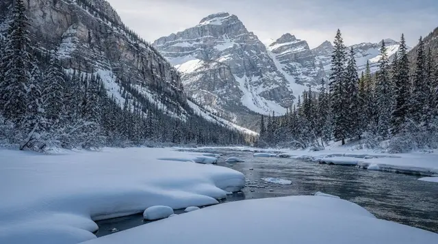
The headline scenery is the Spray Lakes Reservoir itself: a long, glacially fed lake with a colour that shifts from deep blue to a paler, silty green depending on the season and the light, framed by mountains on both sides with almost no development along the shore. Pullouts appear at intervals where the road runs close to the water, and on a calm morning the reflections of the surrounding peaks are the main reason photographers make the drive at all. Because the road runs at some elevation above the water for parts of its length, there are also long sightlines down the reservoir that aren’t available from anywhere closer to Canmore.
This page deliberately doesn’t walk through the individual hiking trails that branch off the corridor — spots like Grassi Lakes, Ha Ling Peak, and Grotto Canyon each have their own coverage, and they’re better understood on their own pages than folded into a driving guide.
What’s worth knowing here is simply that several well-known Canmore-area trailheads are reached via this corridor or its immediate side roads, so the Smith-Dorrien Trail often ends up being the access route for a day that’s really built around a hike rather than the drive itself. If that’s your plan, check the relevant trail page for the specifics and treat this drive as the approach.
Further south, near the Three Sisters area outside Canmore and again closer to the Highway 742 junction, the road passes through open valley sections with wide views rather than dense forest, which is part of what makes it a popular route for cyclists as well as drivers on quiet weekdays.
Wildlife on the Spray Lakes Trail
Wildlife sightings are one of the genuine draws of a slower gravel road through Kananaskis Country, and also the reason to keep speeds down. Elk, deer, and black bears are all plausible sightings along the reservoir corridor, and grizzly bears use this landscape too. The same distance rules that apply throughout the Rockies apply here: stay at least 100 metres from bears and wolves, and at least 30 metres from other wildlife, and never feed an animal, however used to vehicles it seems.
A slow-moving car is also just safer on a gravel road where stopping distances are longer than on pavement, so treat sudden roadside wildlife as a reason to ease off well before you’d need to brake hard. For a fuller rundown of what to expect and how to behave around it, see the wildlife viewing guide and the bear safety guide.
Best time to drive it
Late June through September is the reliable window, once spring runoff has finished reshaping the road surface and before the first real snow of autumn starts complicating things again. Within that window, the road is at its most predictable, though “predictable” for a gravel mountain road still means checking conditions the morning you plan to go, not assuming last week’s report still holds.
Outside that window, the picture gets murkier and more seasonal in a way that doesn’t follow a fixed calendar the way some Parks Canada closures do. Early or late snowfall, spring thaw turning sections to mud, and scheduled grading or maintenance work can all close stretches of the road with little notice, sometimes for a day, sometimes for longer.
Winter driving on the corridor is a different undertaking altogether — icy gravel, drifting snow, and long stretches with no cell service are a poor combination for an unfamiliar visitor, and the winter driving guide is worth reading before attempting it in the colder months. The honest summary: don’t build a trip around this road being open on a specific date without checking current conditions first.
Smith-Dorrien Trail versus the highway route into Kananaskis
| Smith-Dorrien/Spray Lakes Trail | Highway 1 to Highway 40 | |
|---|---|---|
| Surface | Mostly gravel, short paved section near Canmore | Fully paved |
| Typical driving time, Canmore to Kananaskis Lakes | Roughly 1.5–2 hours | Roughly 1–1.5 hours |
| Scenery | Continuous reservoir and mountain views | Highway driving, scenic in parts |
| Traffic | Light, no highway congestion | Can back up on summer weekends |
| Reliability | Weather- and maintenance-dependent | Maintained year-round highway standard |
| Best suited to | Scenic drivers with time to spare | Anyone prioritizing a fast, predictable drive |
Neither option is objectively “better” — they solve different problems. If the goal is simply to get from Canmore to a specific Kananaskis trailhead as efficiently as possible, take the highway. If the goal is the drive itself, the Smith-Dorrien Trail earns its detour.
Practical driving tips
Fill the tank in Canmore before you leave; there’s no fuel sold along the corridor, and running low on a gravel backroad with no cell service is not where you want to discover that. Speaking of cell service, coverage is patchy to absent through much of the route, particularly the further you get from the reservoir’s northern end, so download offline maps in advance and let someone know roughly when you expect to be back on pavement.
Drive with your headlights on, even in daylight — it’s a genuinely useful habit on a dusty gravel road where visibility through another vehicle’s dust cloud can drop to almost nothing for a few seconds. Keep more following distance than instinct suggests, both for the dust and for loose gravel stopping distances. Watch your speed on blind corners along the reservoir, where the road narrows and oncoming traffic, cyclists, and wildlife are all plausible surprises. And if you’re stopping for the view, pull fully off the travelled surface rather than half-parking on the shoulder of a road that often doesn’t have much of one.
Anyone anxious about driving an unfamiliar gravel road, or without their own rental car in the first place, has a reasonable alternative: guided day tours out of Canmore cover much of this same landscape without the responsibility of the driving.
a guided scenic lakes tour that runs out of Canmore into the surrounding national park landscape takes care of the driving and the route-finding for visitors who’d rather look at the scenery than watch the road.
For a different angle on the same general area, some travellers combine a driving day with a short helicopter flight over the peaks and glaciers near Mount Assiniboine, based out of Canmore, which shows the Goat Range and Kananaskis Range terrain from an angle the road never quite offers. There’s also a private, guide-led wildlife and nature drive departing Canmore for visitors specifically interested in the wildlife-watching side of this landscape without self-driving a gravel road.
Seeing the Spray Lakes corridor without your own vehicle
There’s no scheduled public transit along the Smith-Dorrien/Spray Lakes Trail — Roam Transit’s Canmore routes don’t extend onto this gravel corridor, and there’s no shuttle system comparable to the one running to Moraine Lake. Practically speaking, seeing this road means either driving yourself, joining a guided tour that includes it or the surrounding Kananaskis area, or cycling it, which is a genuinely popular option among road cyclists based in Canmore given the light traffic and steady grades.
For visitors weighing whether to rent a car for a Canmore-based day versus relying entirely on guided tours, the guided tour versus rental car guide and the getting around without a car guide both cover the trade-offs in more detail than fits here.
If a rental car is part of the plan regardless, pairing a Smith-Dorrien Trail drive with a broader loop through Kananaskis is the efficient way to use the day; the Kananaskis day trip guide and the Canmore in one day guide both suggest ways to structure that without doubling back on yourself.
Frequently asked questions about the Smith-Dorrien/Spray Lakes Trail
Is the Smith-Dorrien/Spray Lakes Trail paved?
No, not for most of its length. A short section close to Canmore is sealed, but once the road climbs past the Spray Lakes Reservoir it’s a maintained gravel surface the rest of the way to the Kananaskis Lakes junction. Expect washboard, loose gravel, and dust in dry weather, or mud and puddles after rain.
Do I need the Kananaskis Conservation Pass to drive this road?
Yes, on the portion that falls inside Kananaskis Country, which is most of the route once you’re south of Canmore. It’s a separate provincial pass from the Parks Canada pass used in Banff, roughly 15 CAD per vehicle per day or about 90 CAD for the year. See the Kananaskis destination page for exactly where the boundary sits and how to buy it.
Is the Smith-Dorrien Trail open all year?
Not reliably. Sections can close or become difficult to drive after early snowfall, during spring thaw, or for maintenance grading, and the closures aren’t on a fixed annual calendar the way some Parks Canada road closures are. Check current conditions before setting out, especially outside the July-to-September window.
Can I drive it in a regular car, or do I need something with higher clearance?
An ordinary two-wheel-drive car can usually manage it in good summer conditions, since the road is graded and maintained for public use. That said, washboard sections, potholes after heavy rain, and loose gravel on corners are common, and a vehicle with a bit more ground clearance makes for a noticeably smoother, less anxious drive.
Where does the Smith-Dorrien Trail start and end?
It begins at the south end of Canmore, where the Three Sisters Parkway transitions into gravel, and it runs south along the western shore of the Spray Lakes Reservoir before meeting Kananaskis Lakes Trail (Highway 742) near Peter Lougheed Provincial Park. From there it connects onward to the Kananaskis Lakes area and, eventually, back to paved Highway 40.
Is driving the Spray Lakes route faster than taking the highway into Kananaskis?
Usually not. Highway 1 to Highway 40 is the quicker, fully paved way into Kananaskis from Banff or Canmore. The Smith-Dorrien/Spray Lakes Trail is a scenic alternative, not a shortcut: the gravel surface and lower safe speeds mean it typically takes longer than the equivalent distance on paved highway.
Are there gas stations or cell service along the road?
No fuel is sold along the route itself, so fill up in Canmore before starting. Cell coverage is patchy to non-existent through most of the corridor, particularly once you’re away from the reservoir’s northern end, so download offline maps and tell someone your plan before you go.
What will I actually see driving this road?
Long views over the Spray Lakes Reservoir with the peaks of the Goat Range and the Kananaskis Range on either side, occasional wildlife along the roadside, and access points to trailheads and viewpoints without the crowds of the Bow Valley. It’s a drive for the scenery and the quiet more than for any single marquee stop.