Two small lakes, one busy parking lot
Grassi Lakes is a pair of small, spring-fed lakes tucked against the limestone cliffs above Canmore, reached by a short trail rather than a highway pullout. The colour is the draw — both lakes run a saturated turquoise to teal on a sunny day, the same glacial-flour effect that colours Lake Louise and Moraine Lake, though the water here arrives underground rather than straight off a glacier. What makes Grassi Lakes different from most of the postcard lakes in this guide is that you have to walk to it: there’s no roadside view, no drive-up parking lot with the lake already in frame. You park at a trailhead, choose a route, and earn the view in well under an hour.
That combination — short trail, big colour, easy access from a town rather than a remote valley — makes Grassi Lakes one of the most consistently crowded short hikes in the Canmore area. The trailhead lot is small, there’s no shuttle system backing it up the way there is for Moraine Lake, and on a clear July or August morning it can be full by 9 or 9:30 am. None of that makes the hike not worth doing. It does mean showing up with a plan rather than assuming you’ll simply drive up and find a spot.
Where the name comes from
The lakes and trail are named for Lawrence Grassi, an Italian-born miner who settled in Canmore in the early 20th century and spent decades building hiking trails around the Bow Valley in his spare time, largely without pay or official sanction. Several of the trails he cut by hand in the 1920s through 1950s are still in use today, including the route to these two lakes. It’s a rare case in the Rockies of a place named after the person who built the path to it rather than after a survey party, a railway official, or a European place name — worth knowing before you assume every Rockies name traces back to the Canadian Pacific Railway.
Getting to the trailhead
The Grassi Lakes trailhead sits a short drive from downtown Canmore, off the Smith-Dorrien / Spray Trail that heads south toward Spray Lakes Reservoir and Kananaskis — allow about 10 minutes from central Canmore, or 30 to 35 minutes total from Banff townsite (26 kilometres to Canmore, plus the run out to the lot).
The trailhead — shared with Ha Ling Peak, at Goat Creek/Whiteman’s Gap off the Smith-Dorrien/Spray Lakes Road — sits on provincial land in Kananaskis, not inside Banff National Park, so a Parks Canada pass doesn’t apply here. It does mean the separate Kananaskis Conservation Pass is required, priced by the day or the year and per vehicle; it has nothing to do with any Parks Canada pass you might already be carrying for time spent in Banff itself, and the two are checked and priced independently.
The same small parking area also serves the trailhead for Ha Ling Peak, which is why it fills so fast: two popular hikes sharing one lot multiplies the pressure on both. Grotto Canyon, by contrast, has its own separate trailhead off Highway 1A closer to the Bow Valley floor — the three hikes get lumped together in a lot of trip-planning content because they’re all near Canmore, but they don’t share pavement, and confusing the parking situation at one for the other is an easy way to arrive at the wrong lot.
Two ways up: easy loop or steep direct trail
Grassi Lakes is really two trails to the same destination, and picking the right one — or combining them into a loop — matters more here than at most short hikes in this guide.
| Route | Distance | Elevation gain | Surface | Typical time |
|---|---|---|---|---|
| Interpretive trail (easy) | 4.2 km round trip | About 100 m | Wide, graded gravel, switchbacks | 1.5-2 hours |
| Direct trail (steep) | 2.8 km round trip | About 150 m over a shorter distance | Narrower, rockier, steeper switchbacks | 1-1.5 hours |
| Loop (up steep, down easy, or reverse) | About 4 km | About 150 m | Mixed | 1.5-2.5 hours |
The interpretive trail is the easier of the two: a wide, well-graded path that climbs gradually through forest, crosses a bridge near a small waterfall, and arrives at the lower lake without any scrambling or exposed footing. It’s the better choice with young kids, with anyone who’d rather not deal with loose rock, or if you’re not confident about footing on a warm day when the lower sections can turn slick with foot traffic and dust.
The direct trail gets to the same lakes faster but works harder to do it — a steeper, narrower climb with tighter switchbacks and a rockier surface, past the base of a small seasonal waterfall early on. It’s still a hike most reasonably fit visitors can manage without technical gear, but it’s a genuinely different experience from the interpretive route, and conflating the two is the single most common way people end up surprised by the effort involved. A popular option is to go up one way and down the other, making a loop instead of an out-and-back and seeing both sides of the hillside in the process.
Whichever route you take up, this is still an easy-to-moderate outing by Rockies standards — a few hours, well-marked, no exposure to speak of. That’s worth stating plainly because it gets confused, constantly, with Ha Ling Peak, which starts from the same parking lot and climbs the same general hillside toward a 2,408-metre summit with real elevation gain, loose scree, and a very different level of commitment. If a trip report or a photo caption describes Grassi Lakes as a strenuous climb, it’s very likely describing Ha Ling Peak by mistake, or describing someone who kept walking well past the lakes onto a connector trail that isn’t part of this hike at all.
For the difficulty spread across the region’s short hikes, see our roundup of best day hikes by difficulty; the specifics of this trail alone are covered in the dedicated Grassi Lakes trail guide, and the contrast with the peak above it is worth reading in the Ha Ling Peak hike guide before you commit to a route.
What you actually see at the lakes
The trail arrives first at the lower lake, smaller and often the more photographed of the two, set directly against a wall of pale limestone cliff that rises straight out of the water on one side. A short connector leads to the upper lake, slightly larger and a little quieter since a portion of visitors turn back after the first lake.
Both lakes owe their colour to the same underlying cause as the alpine lakes elsewhere in this guide — finely ground rock particles suspended in the water scatter light toward the blue-green end of the spectrum — though the hydrology here is different from a glacier-fed lake like Moraine Lake: Grassi Lakes are spring-fed, with water linked underground to the same drainage system that feeds Spray Lakes Reservoir upstream, which is why the colour and water level here don’t track the exact same seasonal thaw pattern described for the bigger glacial lakes elsewhere in this guide.
Above both lakes, the same limestone cliffs that frame the view are a working rock-climbing crag — one of the more established sport-climbing areas in the Canmore region, with bolted routes visible from the lakeshore on a busy weekend. You don’t need to climb anything to enjoy the hike, but it’s common to arrive at the lower lake and find climbers roped up on the wall above; it’s part of the local scenery here in a way it isn’t at Lake Louise or Moraine Lake, and it’s one of the more distinctive things about this particular hike rather than an incidental detail.
Neither lake has a beach in any real sense, and swimming isn’t the point of a visit — the water is cold even in August, access to the shoreline is limited by rock and vegetation, and the main draw is the view and the photograph rather than time in the water. Treat this as a viewpoint-and-short-walk destination, similar in spirit to Two Jack Lake back in Banff, just reached by trail instead of by car.
The parking problem, plainly
This is the part of the Grassi Lakes visit that trips people up more than the trail itself. The lot at the trailhead is small — a few dozen spaces, not the sprawling paved areas you’ll find at bigger attractions — and it serves both this hike and Ha Ling Peak. On clear weekends from June through September, and especially through the peak July-August stretch, the lot routinely fills by mid-morning. Once it’s full, the realistic options are to wait for a space to open, park considerably further away along the access road (where enforcement does happen), or come back another time.
There’s no shuttle system covering this trailhead the way Parks Canada runs one for Moraine Lake, and no reservation system for parking. The practical fix is timing: arrive before 8:30 am, or push your visit to a weekday, or treat a shoulder-season trip (late May, or September into early October) as the trade-off between fewer crowds and a greater chance of mud or lingering snow on the shaded, steeper sections of the direct trail.
If you’re staying in Banff rather than Canmore, that early start also has to account for the 30-plus minutes of driving before you’re even at the lot, which pushes a genuinely early departure into “leave before you’ve had coffee” territory in high season.
When to go
June to September is the reliable window, with July and August delivering the most saturated lake colour and the heaviest crowds in the same breath — the two are not a coincidence, since good weather draws hikers and photographers on the same schedule.
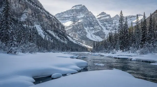
Late May and October can work for a quieter visit, but check current trail conditions before committing: the direct trail’s steeper, shaded switchbacks hold snow and ice longer into spring than the open, sun-exposed sections lower down, and an easy walk in July can become a genuinely slippery one in a shoulder-season October cold snap. Winter visits happen — the lakes and lower falls can freeze into scenery of their own — but expect ice underfoot on both routes and treat traction devices as necessary rather than optional if you’re going in December through March.
Practical basics
Bring proper footwear even for the “easy” interpretive route — it’s graded and wide, but still a dirt-and-gravel forest trail with tree roots and, after rain, some genuinely slick sections. There’s no food or water for sale at the trailhead or along the trail, so pack what you need; the nearest reliable options are back in Canmore town itself.
Bear activity is a normal part of the Bow Valley, this hike included, and carrying bear spray — and knowing how to use it — is standard practice here the same as it is on trails inside Banff National Park; our guide to bear safety, bear spray, and flying with it covers what you actually need to know before setting out. This isn’t one of the routes where hiking in a group of four is enforced the way it sometimes is around Larch Valley in late September, but the general wildlife caution that applies across the Bow Valley applies here too.
Dogs are permitted on leash on both routes. There are no washroom facilities at the lakes themselves; the trailhead lot has basic facilities that can be stretched thin on a busy day. Cell coverage is patchy once you’re into the trees, which is worth knowing if you’re relying on a phone map to choose between the two routes rather than picking one before you set out.
Doing it with a guide instead
If you’d rather not deal with the parking lot or the route-choice question yourself, a guided option folds Grassi Lakes into a half-day out of Canmore or Banff, usually paired with Grotto Canyon or a wider scenic loop, with transportation and route-finding handled for you. The small-group tour that pairs Grassi Lakes with a Grotto Canyon walk is built around exactly this pairing, run from Banff with transport included, which sidesteps the parking question entirely since the vehicle handles it.
There’s a similar option built for travellers routing through Calgary or staying in Canmore itself, the Grassi Lake and Grotto Canyon hiking day trip covering Calgary, Canmore, and Banff, which works well if you’re not based in Banff at all.
For visitors who want the lakes as one stop inside a broader look at the Canmore and Banff National Park scenery rather than a dedicated hiking outing, the Canmore and Banff National Park scenic lakes tour covers more ground with less walking, which suits anyone short on time or not up for even the easier of the two trail options here. None of these substitute for the free, self-guided version of the hike — they exist for people who’d rather trade the parking lot and the route decision for a booked seat.
How it compares to the other Canmore-area hikes
Grassi Lakes, Ha Ling Peak, and Grotto Canyon all get mentioned in the same breath as “short hikes near Canmore,” and they do share a general area, but they’re three different outings with three different effort levels and, in two of the three cases, different trailheads entirely. Grassi Lakes and Ha Ling Peak share a parking lot but split almost immediately — Grassi Lakes to an easy-to-moderate walk to two lakes, Ha Ling to a genuinely strenuous climb toward a summit with real elevation gain and loose footing near the top.
Grotto Canyon runs from its own separate trailhead off Highway 1A and follows a dry creek bed through a narrow limestone gorge rather than climbing to any lake at all. If your plan for the day is “do a Canmore hike” without a firm sense of which one, working out the effort level you actually want first will save you from either an underwhelming stroll or an unplanned scramble. For visitors weighing all three alongside Canmore’s other options in a single day, the Canmore in one day guide lays out how they fit together, and mountain biking in Canmore covers the same general area for anyone swapping boots for wheels.
Grassi Lakes FAQ
How long is the Grassi Lakes hike?
About 4.2 kilometres round trip on the easy interpretive trail, or as short as 2.8 kilometres if you take the steeper direct trail one way. Most visitors are done, including time at both lakes, in 1.5 to 2.5 hours.
Is the Grassi Lakes hike easy or hard?
Easy to moderate. The interpretive trail is a wide, gradually climbing path suitable for most fitness levels; the direct trail is steeper and rockier but still well short of a technical climb. Neither route resembles the much harder scramble up nearby Ha Ling Peak, which shares the same trailhead but is a different hike.
Where do you park for Grassi Lakes?
At a small dedicated trailhead lot off the Smith-Dorrien / Spray Trail south of Canmore, shared with the Ha Ling Peak trailhead. It’s a short drive from downtown Canmore and about 30 to 35 minutes total from Banff. The lot commonly fills by mid-morning on clear summer weekends, with no shuttle backup, so arriving before 8:30 am or going on a weekday improves your odds noticeably.
Do you need a park pass for Grassi Lakes?
Yes, but the specific pass matters. The trailhead sits on provincial land in Kananaskis, not inside Banff National Park, so a Parks Canada pass doesn’t cover it — you need the separate Kananaskis Conservation Pass, priced by the day or the year and per vehicle.
Can you swim in Grassi Lakes?
Not really in any practical sense. The water is cold year-round, shoreline access is limited by rock and vegetation, and the hike is built around the view rather than time in the water.
How does Grassi Lakes compare to Grotto Canyon?
They’re unrelated trails that happen to sit near the same town. Grassi Lakes climbs to two turquoise lakes below a climbing cliff from a trailhead south of Canmore; Grotto Canyon follows a flat, dry creek bed through a narrow gorge from a separate trailhead off Highway 1A. Neither substitutes for the other, and they don’t share parking.
Is Grassi Lakes worth visiting in winter?
Yes, if you’re prepared for ice on both routes — the lakes and the lower falls take on a different, quieter character under snow. Traction devices are worth treating as necessary rather than optional, since both trails hold ice on shaded sections well into spring.
Are dogs allowed at Grassi Lakes?
Yes, on leash, on both the interpretive and direct trails.