Plain of Six Glaciers hike: the full trail guide
How long is the Plain of Six Glaciers hike?
It runs about 5.5 kilometres one way from the Lake Louise lakeshore, so 11 kilometres round trip, with roughly 365 metres of elevation gain. Most people take four to five hours including a stop at the teahouse near the end.
A valley trail, not a lake trail
Plain of Six Glaciers starts at the same spot as the Lake Agnes Tea House hike — the lakeshore path in front of the Fairmont Chateau Lake Louise — and that shared start is the reason the two get mixed up constantly. They are different trails with different destinations. Lake Agnes climbs to a small alpine lake tucked behind Big Beehive. Plain of Six Glaciers stays at a lower grade for longer, follows the Lake Louise valley up toward Mount Victoria, and finishes at a second teahouse looking directly at a string of hanging glaciers rather than at a lake.
If your plan is Moraine Lake or Larch Valley, this is not that trail — those sit in a separate valley reached from a separate access point, and the route there involves the mandatory shuttle system covered in the Moraine Lake shuttle guide. This page is only about the Lake Louise side of the mountain.
Trail stats at a glance
| Detail | Figure |
|---|---|
| Trailhead | Lakeshore path, Lake Louise, near the Chateau boathouse |
| Distance one way | About 5.5 km to the teahouse |
| Round trip | About 11 km (add ~1 km for the glacier viewpoint extension) |
| Elevation gain | Roughly 365 m |
| Typical time | 4 to 5 hours round trip, longer with the viewpoint |
| Difficulty | Moderate — steady climb, no scrambling to the teahouse |
| Season | Trail usually clear mid-to-late June through October; teahouse open roughly June to early October |
| Payment at teahouse | Cash strongly preferred |
These numbers are approximate and vary slightly depending on where you start measuring from and whether you push on to the viewpoint above the teahouse.
The route, stage by stage
Lakeshore to the Highline junction
The first 2.1 kilometres follow the flat, wide lakeshore trail along the north side of Lake Louise, the same stretch used by everyone headed to either teahouse. It is level, well maintained, and busy — this is the most crowded segment of the day by a wide margin. At the far end of the lake the trail leaves the shoreline and begins to climb through forest. A signed junction marks the split: right continues toward Lake Agnes and the Big Beehive, left drops you onto the Highline trail toward Plain of Six Glaciers. Missing this junction and ending up on the wrong trail is the single most common mix-up hikers report, so read the sign carefully.
Into the hanging valley
Past the junction the trail contours across open slopes with the first real views back down onto the turquoise water and, increasingly, up toward the glaciated wall at the head of the valley. This section gains elevation steadily but not steeply, crossing a couple of avalanche paths and rockier ground before dropping slightly to rejoin the main valley floor near the toe of the moraine below Mount Victoria. The glacier that gives Lake Louise its colour sits directly ahead, and from here the trail is a straightforward, gradual approach up the valley.
The teahouse and the glacier viewpoint
The final approach climbs through subalpine forest and past increasingly close views of the glacier before reaching the Plain of Six Glaciers Teahouse, perched on a rocky bench with the ice field filling the view. Most hikers stop here. Those with energy left can continue another 20 to 30 minutes on a rougher, narrower trail to a viewpoint that looks toward Abbot Pass and gives a wider look at the glaciers ringing the head of the valley. This extension is exposed in places and not maintained to the same standard as the main trail — treat it as optional, not a required add-on.
The Plain of Six Glaciers Teahouse
This is the lesser-known of the two Lake Louise teahouses, and it draws a smaller crowd than the Lake Agnes one, though “smaller” still means busy on a clear July afternoon. It serves a simple menu — soup, sandwiches, baked goods, tea by the pot — supplied by pack train rather than road, which is part of why prices run higher than in town and why the operation is seasonal. Expect it open roughly June through early October, closing earlier if snow arrives ahead of schedule. As with its counterpart at Lake Agnes, card payment is unreliable here; carry cash. There is no cell signal at either teahouse, and no resupply beyond what they serve, so treat lunch here as a bonus, not something to plan your whole food strategy around.
There is usually a wait for a table on the outdoor benches at peak lunch hours in July and August, and staff generally ask that you order something if you sit down rather than just use it as a rest stop — reasonable, given everything on the menu arrived on a horse. If the benches are full, the open ground just below the teahouse works as a quieter spot to eat a packed lunch with the same view, without adding to the queue.
Photographers should note the light: the glacier wall faces roughly east-to-southeast, so it catches direct morning sun and can go flat and hazy by mid-afternoon in summer. An early start pays off twice here — better light on the ice, and a shot at a table before the busiest window.
a guided hike to the Lake Agnes teahouse is a reasonable way to see the other side of this same valley system if you have an extra day, with a guide handling the route-finding and the natural history commentary along the way.
Combining it with Lake Agnes Tea House
A connector trail links the two teahouses directly, so it is possible to visit both in one long outing — roughly 14 to 15 kilometres and close to 700 metres of cumulative elevation gain by the time you factor in the up-and-down between them. This is a legitimate option for strong hikers with a full day and good weather, but it is not something you need to do. Plenty of visitors do one trail, have a good day, and leave the other for a future trip. If you are deciding which single trail to pick, the Lake Agnes Tea House hike is shorter and busier with a lake at the end; this one is a touch longer with glacier views instead. Neither is objectively better — they show different things.
For a broader comparison of trail options around the valley, see best day hikes by difficulty.
When to go
At just over 2,100 metres near the teahouse, this valley holds snow later into the season than the townsite. The trail is often still snow-covered or icy into early-to-mid June even in years when Lake Louise itself is starting to thaw; check current trail reports before an early-season attempt, and expect microspikes to help on shaded sections through June. Peak wildflower and clear-glacier viewing runs July through September. By early October the teahouse typically closes for the season, and snow can return to the upper valley at any time, even in summer — pack layers regardless of the forecast in town.
Crowding follows the same pattern as everywhere at Lake Louise: mornings are calmer, and the lakeshore section stays busy all day regardless of when you start. For a sense of when the whole Lake Louise basin is quietest, see lake crowds and quiet times.
Getting to the trailhead
The trail starts right at the Lake Louise lakeshore, in front of the Chateau, which means the access question is really a parking and shuttle question rather than a separate drive. Parking at the lake is limited, often reserved in advance, and fills early in summer; see parking at Banff and Lake Louise for the current system, including the overflow lot at the Lake Louise ski area with a connecting shuttle.
If you are coming up from Banff without a car, a shuttle or an organized tour is the simplest option — a private transfer such as a chartered minivan between Lake Louise and Calgary can also work as one-way transport if you are combining the hike with an onward flight.
If you would rather not manage logistics at all, a Lake Louise and Moraine Lake tour with hiking options bundles transport with time on the trail, though check what specific hike is included before booking, since some itineraries stick to the lakeshore rather than continuing to either teahouse.
What to bring and bear safety
This is bear country, and the valley above Lake Louise sees regular grizzly activity. Carry bear spray on your pack strap, not buried in a bag, and make noise on quieter stretches of trail, particularly near the Highline junction and through the forested sections below the teahouse. Bear spray cannot be carried on a plane in any form, checked or carry-on, so buy or rent a canister locally rather than trying to bring one from home — see bear safety, bear spray, and flying for the specifics. Trail and area closures do happen here for wildlife management; check the noticeboard at the trailhead the morning you go.
Beyond bear spray, pack layers even in midsummer — the upper valley is noticeably colder and windier than the lakeshore — along with sun protection, more water than you think you need, and sturdy footwear with ankle support for the rockier ground past the junction. See what to pack for summer and winter for a fuller list.
Difficulty and who should skip it
Rated moderate rather than easy: the distance and the sustained, if gentle, elevation gain add up over 11 kilometres, and the terrain past the junction is uneven enough that trail runners and light hikers do best. It is not technical — no exposed scrambling is required to reach the teahouse — but it is longer than most casual walkers expect from a “teahouse hike.” Families with young children, or anyone short on time, are generally better served by the flat lakeshore section alone, or by one of the easy, accessible trails around Banff that don’t require the full round trip.
Booking a guided hike instead
If you would rather not navigate the junction, manage bear safety solo, or figure out the teahouse cash situation on your own, a guided option removes most of that friction. A guided Lake Louise and Moraine Lake tour is worth considering if you want to see both iconic lakes in the same day and are open to a shorter, guide-led walk rather than the full independent hike described here. For a broader look at when a guide earns its cost versus a rental car and a trail map, see guided tour versus rental car.
Questions about the Plain of Six Glaciers hike
How far is the Plain of Six Glaciers hike?
About 5.5 kilometres one way from the boathouse at Lake Louise, or 11 kilometres round trip if you go to the teahouse and back. Adding the short extension to the glacier viewpoint above the teahouse adds roughly another kilometre round trip.
Is Plain of Six Glaciers the same trail as Lake Agnes Tea House?
No. They share the same trailhead at the Lake Louise lakeshore and the first stretch of trail, then split at a signed junction. Lake Agnes climbs to a smaller alpine lake; Plain of Six Glaciers stays lower and heads up the valley toward Mount Victoria.
Can I hike both Lake Agnes and Plain of Six Glaciers in one day?
Yes, a connector trail links the two teahouses, making a loop of roughly 14 to 15 kilometres with close to 700 metres of total elevation gain. It is a long day and not required — most visitors are satisfied picking one trail.
Does the Plain of Six Glaciers Teahouse take cards?
Not reliably. Like the Lake Agnes teahouse, it is a seasonal, off-grid operation and cash is the safer bet. Bring small bills in Canadian dollars in case the card terminal is down, which happens.
When is the Plain of Six Glaciers trail open?
The teahouse typically operates from June to early October, weather dependent, but the trail itself can be walked once the snow clears, usually by mid-to-late June. Lake Louise itself is still often frozen or partly frozen at that point.
Do I need bear spray for this hike?
Carrying bear spray is strongly recommended on this trail, as it is on nearly every trail out of Lake Louise. It cannot travel in checked or carry-on luggage on a flight, so buy or rent it in Banff, Lake Louise, or Canmore before you start.
Is this hike suitable for kids or beginners?
The first stretch along the lakeshore is flat and manageable for most fitness levels. Past the Highline junction the trail climbs steadily, and the full round trip to the teahouse is a moderate outing better suited to hikers with some stamina than to young children.
Where does the trail end?
The maintained trail ends at the Plain of Six Glaciers Teahouse, with an optional rougher extension to a viewpoint looking toward the Victoria Glacier and the route to Abbot Pass. Beyond that point the terrain becomes exposed scrambling and is not a casual extension.
Columbia Icefield & glacier tours on GetYourGuide
Verified deep-linked GetYourGuide tours. Book through these links and we earn a small commission at no cost to you.
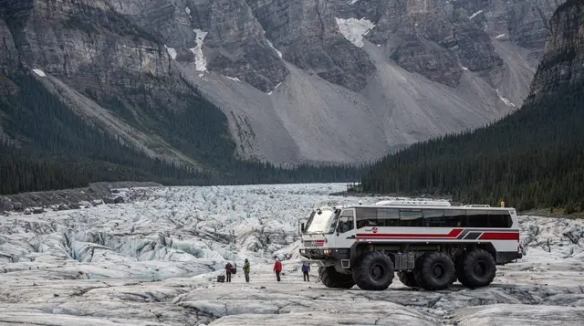
GetYourGuide does not provide a product photo for this activity — the image shows the meeting point, photographed by us.