A short detour that isn’t the canyon you’re thinking of
The Icefields Parkway is 232 kilometres of glaciers, turquoise lakes, and high alpine scenery, and it’s easy to assume every stop on it needs an hour or more. Mistaya Canyon is the exception. It’s a narrow gorge cut by the Mistaya River, reached by a short, well-defined trail from a dedicated parking area right off the highway, and the whole round trip — parking lot to footbridge to potholes and back — takes most people 20 to 30 minutes. That makes it one of the easiest stops to add to an already full day, and one of the easiest to skip past without noticing, since the pullout gives no hint from the road of what’s a short walk away.
It’s worth being direct about something before going any further: Mistaya Canyon is its own site, separate from the other two canyons visitors in this region tend to hear about. Johnston Canyon is well south of here, off the Bow Valley Parkway near Banff, with a longer boardwalk trail leading to a set of waterfalls. Maligne Canyon sits near Jasper, close to 175 kilometres north of Mistaya.
All three canyons share a similar origin story — fast glacial meltwater cutting through bedrock over thousands of years — but they are different places, on different roads, with different trails, and none of them connect to one another on foot or by any shuttle. If an itinerary or a search result implies you can combine Mistaya with Johnston Canyon in the same short stop, that’s wrong; they’re roughly 115 kilometres apart.
Where it is, and how to get there from Banff
Mistaya Canyon sits on the Icefields Parkway (Highway 93 North), about 115 kilometres from Banff and a few kilometres south of Saskatchewan River Crossing — the last reliable, though seasonal, fuel stop before Jasper. Coming from Banff, plan on roughly 1 hour 30 minutes of driving before the turnoff, more if you’ve already made the standard stops at Bow Lake, Peyto Lake, and the Crowfoot Glacier viewpoint along the way, which most people do.
| From | Distance | Drive time (no stops) |
|---|---|---|
| Banff | 115 km | About 1 h 30 min |
| Lake Louise | 60 km | About 45 min |
| Saskatchewan River Crossing | 5 km | About 5 min |
| Columbia Icefield | 65 km | About 45 min |
| Jasper | 175 km | About 2 h |
The parking lot sits directly off the highway on the west side, well signed but easy to blow past at highway speed if you aren’t already watching for it. There’s no fee booth and no facilities beyond a pit toilet in most seasons — this is a bare-bones pullout, not a visitor centre. A valid Parks Canada pass covers your presence here the same way it covers the rest of the parkway; there’s no separate ticket for the canyon itself.
The parking lot problem nobody mentions
Here’s the trap: because the walk takes so little time, the lot turns over constantly through July and August, and it is genuinely small — a few dozen spaces at most, with no overflow area and nowhere obvious to pull off along the shoulder without blocking traffic. A stop that should take half an hour can turn into a longer wait for a spot to open up if you arrive at midday in peak season.
This is a real and common frustration on this stretch of the Icefields Parkway, and it catches people off guard precisely because the site sounds minor compared to Peyto Lake or the Columbia Icefield. Arriving early in the morning or later in the afternoon, when tour buses and the bulk of day-trip traffic have thinned out, is the practical fix. If the lot is full when you arrive, circling back after the next stop up or down the road is usually faster than waiting it out.
The walk itself
From the parking lot, the trail descends gradually through spruce and fir forest toward the river, then climbs slightly to a wooden footbridge that spans the canyon at its narrowest point. The path is well maintained and doesn’t require any special footwear beyond decent walking shoes, but it isn’t flat the whole way — expect a modest grade in both directions, more noticeable on the return climb back to the lot. Total distance is roughly 1 kilometre round trip, and 20 to 30 minutes covers it comfortably for most visitors, including a few minutes standing on the bridge.
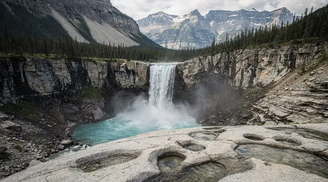
The canyon itself is the payoff: a slot only a few metres wide in places, walls striated by thousands of years of the Mistaya River cutting through the limestone bedrock, with the water visible far below through the gaps in the rock. Along the canyon walls and in the streambed you can pick out giant’s kettles — smooth, rounded potholes ground into the rock by swirling meltwater carrying sand and stone, a textbook example of glacial-meltwater erosion at work. They’re some of the most distinctive formations of their kind anywhere on the parkway, and worth taking the extra minute to actually look for from the bridge rather than just snapping a photo of the gorge and moving on.
Safety: the part worth taking seriously
The bedrock around the canyon rim is smooth, and in places it’s genuinely close to the drop with no railing or barrier at all. That combination — slick rock, real exposure, and a footbridge that funnels foot traffic right along the edge — is exactly the setup where a moment of inattention has consequences. A few points worth keeping in mind:
- Wet rock near the canyon is dangerous, not just slippery-in-theory. Spray from the river, rain, or simply the shaded, damp microclimate right at the gorge keeps the rock wet more often than the surrounding trail, and smooth limestone holds almost no grip when wet.
- Not every viewpoint has a barrier. Unlike a fully railed boardwalk, some sections along the canyon rim are open rock with a real drop just past the edge. Stay well back from any edge you haven’t confirmed is solid ground, especially with children or in a group where someone might be watching the view instead of their footing.
- The footbridge itself is safe when used normally, but it can get crowded in peak season, and leaning out over the rail for a photo is not worth the risk given how narrow and deep the drop below is.
- Don’t attempt to climb down into the canyon or along the streambed. There’s no sanctioned route to the water, and the same erosion that carved the kettles has left the rock unpredictable underfoot.
None of this makes Mistaya Canyon unusually dangerous compared to other short walks on the parkway — it’s a well-used, well-signed trail — but the combination of a very short, low-effort walk and genuinely unguarded edges is exactly the kind of site where visitors let their guard down. Treat it with the same caution you’d give a longer, harder trail.
When to go
The canyon is accessible whenever the parkway itself is open and the trail is clear, but the practical window for a comfortable visit is June through September. Earlier in the season, snowmelt can leave the trail muddy and the footbridge approach icy in shaded sections; the Icefields Parkway corridor holds cooler temperatures and later snowmelt than Banff or Canmore even in a normal year. Outside of summer, check conditions before making the detour — a short walk isn’t worth doing on an icy, unmaintained trail with unguarded drops nearby.
Building it into a parkway day
Mistaya Canyon works best as one stop among several on a longer Icefields Parkway day rather than a dedicated outing on its own — nobody drives 115 kilometres from Banff purely for a 20-minute walk. It sits naturally between the Bow Summit/Peyto Lake area and Saskatchewan River Crossing, making it a logical stretch-your-legs break partway through the drive north, whether your final destination for the day is the Columbia Icefield or all the way through to Jasper.
For travellers who’d rather not self-drive the whole corridor, the guided day trip that pairs Mistaya Canyon with Abraham Lake and Tangle Creek covers this stop alongside two other worthwhile detours off the main parkway sequence, without the logistics of planning fuel and timing yourself.
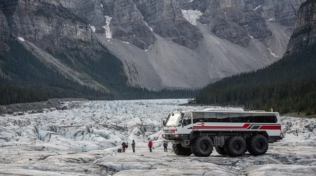
If your day is built around the Columbia Icefield rather than Abraham Lake, the combined Ice Explorer and Glacier Skywalk ticket is worth booking ahead regardless of whether you stop at Mistaya on the way, since Icefield Centre tickets sell out on short notice in peak season; checking the discounted Columbia Icefield ticket before paying full rate is worth the extra minute either way.
If your route runs the other direction — south from Lake Louise toward Kootenay rather than north toward Jasper — the Lake Louise, Marble Canyon and Emerald Lake tour covers a different set of canyon and lake stops and isn’t a substitute for a Mistaya Canyon visit, since it doesn’t touch this stretch of highway at all.
Practical notes
| Detail | What to know |
|---|---|
| Parking | Small lot directly off Highway 93, fills up in July/August |
| Fee | None beyond your Parks Canada pass |
| Facilities | Pit toilet in most seasons, no food or water for sale |
| Trail surface | Packed dirt path, wooden footbridge, some exposed rock near the rim |
| Cell coverage | Patchy to none — this section of the parkway has limited service |
| Nearest fuel | Saskatchewan River Crossing, about 5 km north, seasonal hours |
Gas and cell coverage along this stretch of the parkway are both limited enough to plan around; the gas and cell coverage guide is worth a look before you set out for the day, particularly if Mistaya Canyon is one stop among several and you’re not planning to backtrack.
Mistaya Canyon FAQ: what to know before you stop
How long is the walk to Mistaya Canyon?
About 20 to 30 minutes round trip from the parking lot to the footbridge and back, with a short, mostly gentle grade. It’s one of the shortest stops on the whole Icefields Parkway, which is part of why the small lot fills up fast on summer afternoons.
Is Mistaya Canyon the same as Johnston Canyon or Maligne Canyon?
No, and this is a common mix-up because all three are canyon walks on roughly the same stretch of highway. Mistaya Canyon sits on the Icefields Parkway between Lake Louise and Saskatchewan River Crossing. Johnston Canyon is a separate site further south near Banff, off the Bow Valley Parkway. Maligne Canyon is near Jasper, well north of Mistaya. They don’t connect, and an itinerary that treats them as one stop is wrong.
Is there an entrance fee for Mistaya Canyon?
There’s no separate ticket for the canyon itself, but you need a valid Parks Canada day pass or Discovery Pass to be anywhere on this stretch of the Icefields Parkway, including a quick stop at the Mistaya lot. Check the current official rate before you go rather than assuming last year’s price.
Is the Mistaya Canyon trail safe for kids?
The walk itself is short and not technically difficult, but the rock around the canyon rim and near the footbridge is uneven, often wet from spray, and in places has no railing at all. Keep a close hand on children near the edges, and treat the smooth rock surfaces as slippery even when they look dry.
What are the giant’s kettles at Mistaya Canyon?
They’re smooth, rounded potholes carved into the bedrock by swirling meltwater carrying sand and gravel, visible from the footbridge and along the canyon walls. The same glacial-meltwater erosion that cut the narrow gorge is what shaped these formations over thousands of years, and they’re the single most distinctive thing to look for once you’re on the bridge.
How busy does the Mistaya Canyon parking lot get?
Busier than the short walk suggests. The lot is small, it sits directly off the Icefields Parkway with no overflow area, and because the stop takes so little time, cars turn over constantly during July and August. Arriving early or late in the day, or simply accepting a short wait for a spot, is the realistic plan in peak season.
Can you swim or wade at Mistaya Canyon?
No. The water is fast-moving glacial meltwater funnelled through a narrow gorge, the rock around it is slick, and there’s no safe access to the water from the trail or bridge. Treat this as a viewing stop, not a place to get in or near the current.
Is Mistaya Canyon worth stopping for on a one-day Icefields Parkway drive?
Yes, precisely because it costs so little time. At 20 to 30 minutes round trip, it fits easily into even a tightly scheduled one-day drive between Lake Louise and the Columbia Icefield, and it delivers a genuinely different kind of scenery — a narrow, water-carved gorge — than the lake and glacier viewpoints that dominate the rest of the route.